This page presents the results of the projects:
1) Ethnic Diversity on Maps of the Czech Lands - Cartographic Image and Reality which was supported by the Strategy AV 21 programme "Memory in the Digital Age", research topic "Digital Humanities – accessibility, storage and rescue of sources in digital age".
2) Nations and nationalities of Central Europe in cartographic representation (1800–1945), supported by the Herzog-Ernst-Fellowship (Universität Erfurt, Forschungskolleg Transkulturelle Studien / Sammlung Perthes, Gotha).
Researcher: Jitka Močičková, Institute of History of the Czech Academy of Sciences

RESULTS
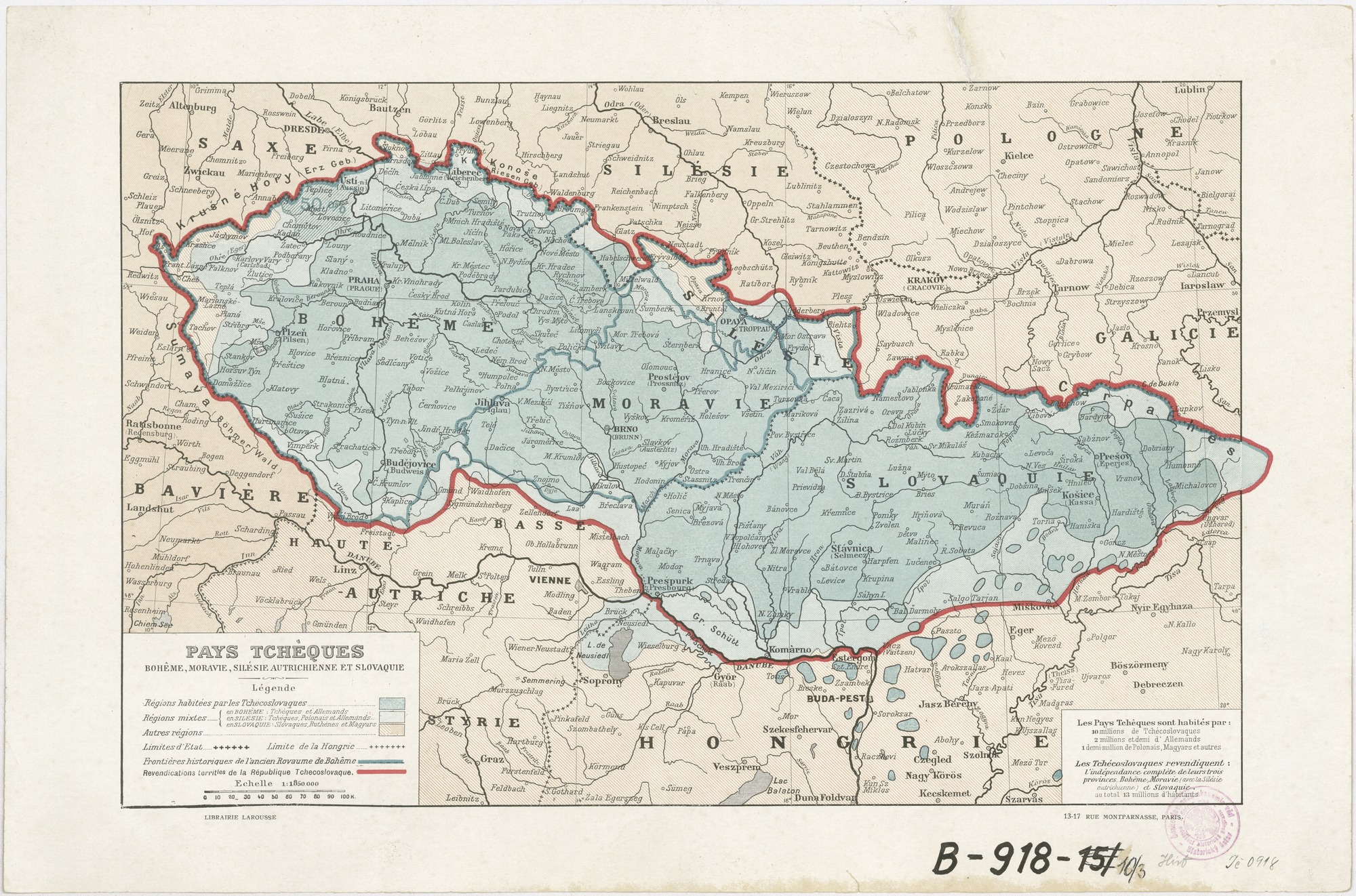
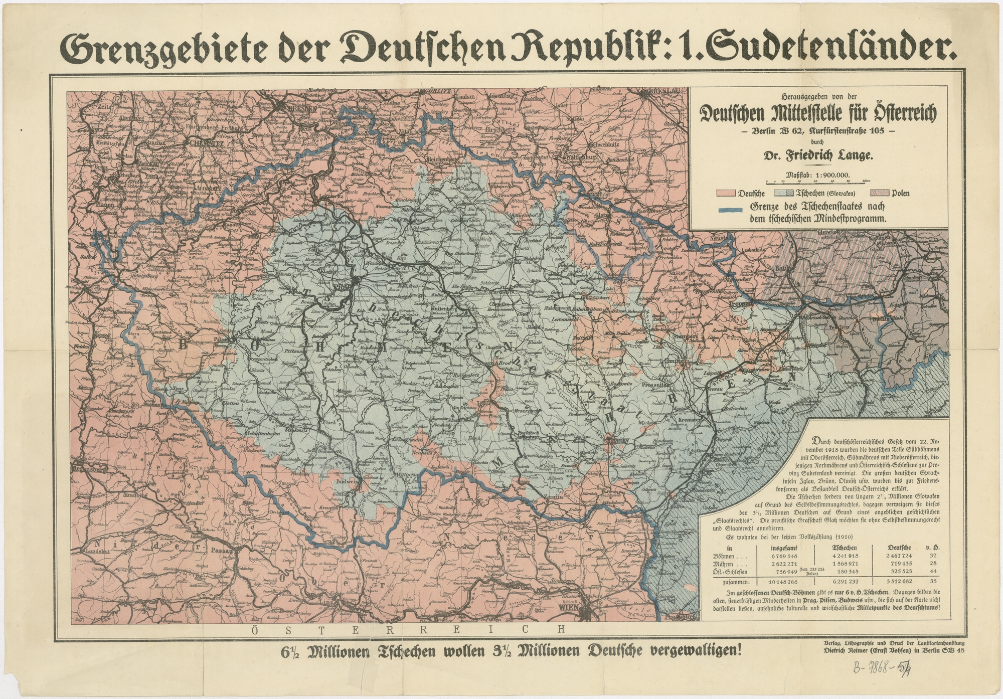
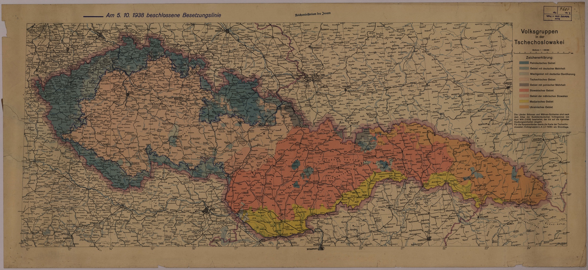
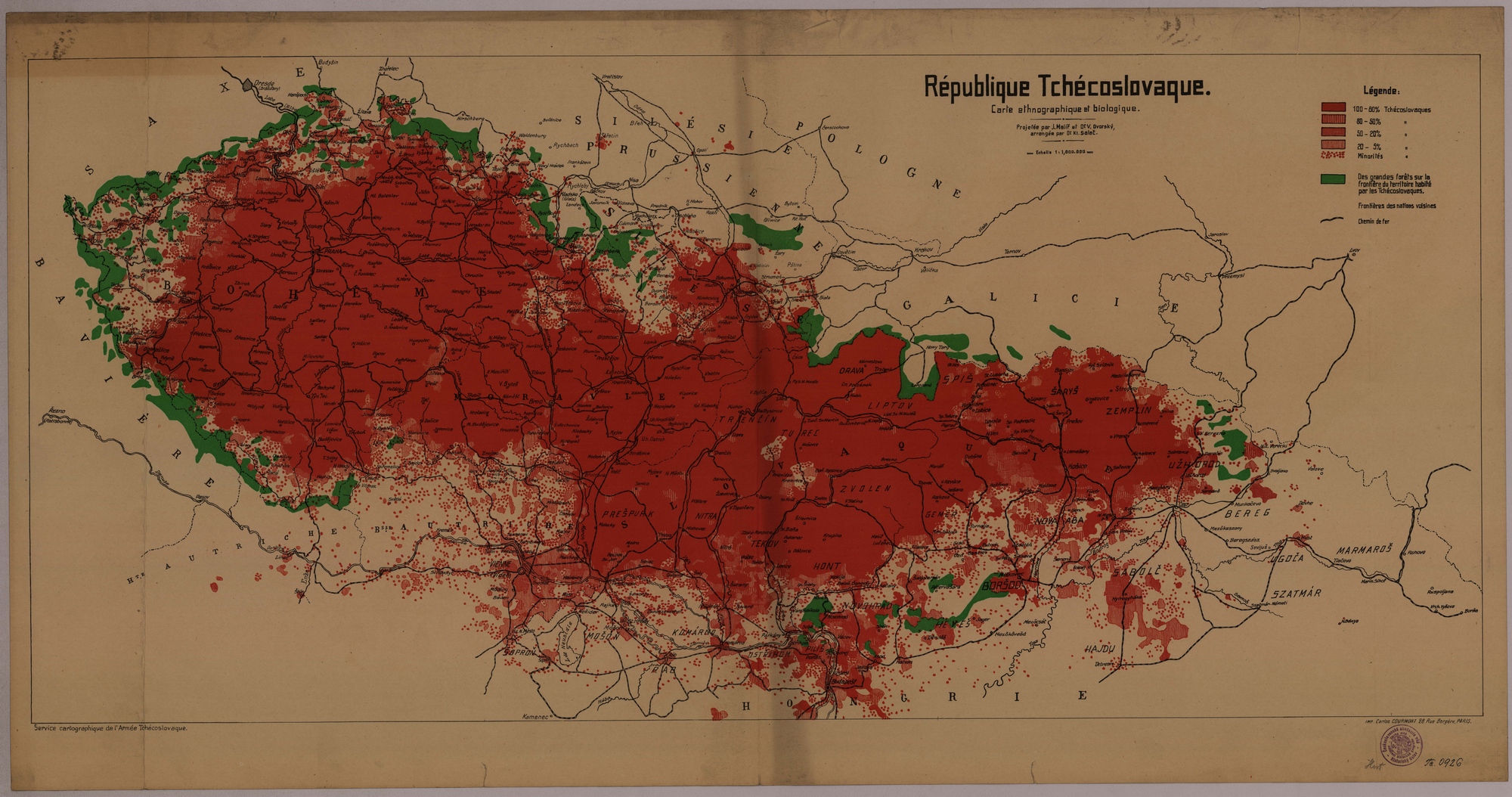
The results of research on the cartographic representation of the Czech-German national border in the 19th and the first half of the 20th century are summarised in the study Stanislav HOLUBEC – Jitka MOČIČKOVÁ, Zobrazování česko-německé národnostní hranice na mapách v období cca 1820–1940, Historická geografie 46/2, 2020, s. 283–340. (available here)
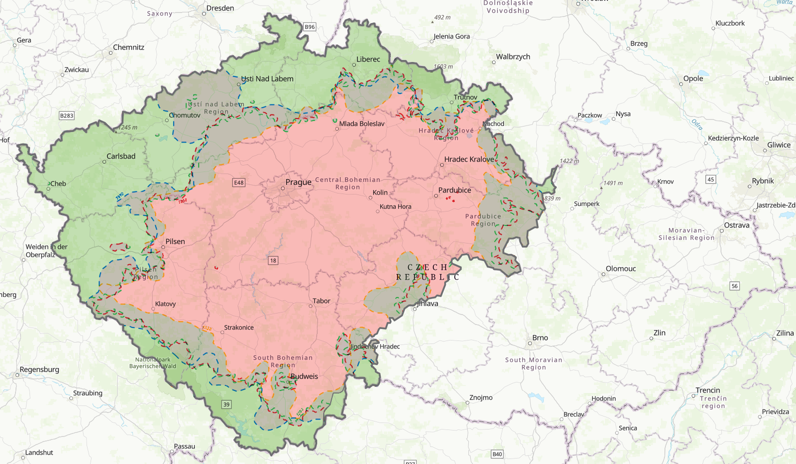
Web map application
Web map applications created in GIS environment show to what extent the representation of the Czech-German ethnic border differed on individual maps of Czech, German and Austrian provenance in the period from the mid-19th century to the 1930s. They allow the comparison of the specific course of this border on thirty selected ethnic maps, and to trace the degree of manipulation within the cartographic production of each nation. The selection includes both maps that depict the ethnic border correctly and maps that are highly manipulative. Setting in a broader historical context is facilitated by the accompanying layers of contemporary administrative divisions of the state (state or provincial boundaries, county and district boundaries).
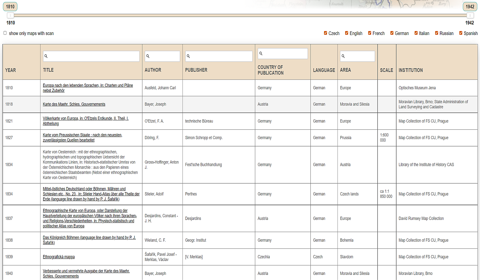
Map database
The database of maps depicting the Czech-German ethnic border in the period ca 1820–1940 provides a detailed bibliographic description of more than 350 maps depicting the Czech-German ethnic border. In addition to standard bibliographic data, it also provides information on the place of deposit of the maps (Czech and foreign memory institutions) and, in many cases, links to digital copies of the maps in various virtual map collections.