This project was supported by the Strategy AV 21: Anatomy of European Society; Cultural heritage as part of European and global discourse
Principal investigator: prof. PhDr. Eva Semotanová, DrSc., Institute of History of the Czech Academy of Sciences
Project team:
PhDr. Eva Doležalová, Ph.D., Institute of History of the Czech Academy of Sciences
PhDr. Jan Frolík, CSc., Institute of Archeology of the Czech Academy of Sciences
Mgr. Petra Justová, Czech Technical University in Prague, Faculty of Civil Engineering, Department of Geomatics
Mgr. Jitka Močičková, Ph.D., Institute of History of the Czech Academy of Sciences
PhDr. Robert Šimůnek, Ph.D., DSc., Institute of History of the Czech Academy of Sciences
prof. PhDr. Josef Žemlička, DrSc., Institute of History of the Czech Academy of Sciences

RESULTS

Web map application
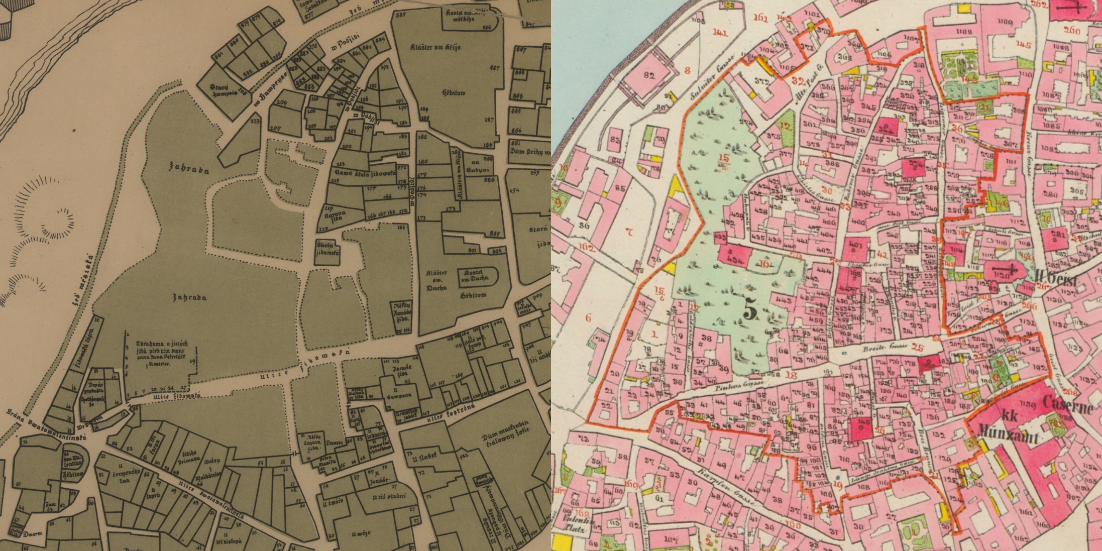
The interactive web map application captures Prague using the unique plan by Václav Vladivoj Tomek (1892), reconstructing the medieval settlement of Prague’s towns up to the pre-Hussite era, in comparison with time horizons at the end of the 18th century (Herget’s Plan of Prague, 1790/1791), in the first half of the 19th century (Jüttner’s plan of Prague, 1815), on the imperial legal deposit imprint of the map of the stable cadastre (1842), after the urban renewal of Josefov at the beginning of the 20th century (1910) and at present.

Papers
- Eva Semotanová, Předhusitská Praha na plánu Václava Vladivoje Tomka z roku 1892 [Pre-Hussite Prague on the plan of Václav Vladivoj Tomek from 1892], in: Husitství - reformace - renesance : sborník k 60. narozeninám Františka Šmahela = Hussitism - reformation - renaissance : volume to the 60th birthday František Šmahel. Praha : Historický ústav AV ČR, 1994, pp. 1001–1012. (available here)
- Jitka Močičková ‒ Eva Semotanová ‒ Petra Justová, Plán středověké Prahy Václava Vladivoje Tomka: nové pohledy, možnosti výzkumu a prezentace nástroji digital humanities = Václav Vladivoj Tomek‘s Map of Medieval Prague: New Perspectives, Research Opportunities and its Presentation through Digital Humanities Tools, Historická geografie 50/2, 2024, s. 137‒156. (available here)


