Borders and Territories
In historical cartography and historical geography, the territories and state borders represent one of the fundamental issues. Historical maps and atlases depict borders and their delineations also in relation to the development of regions and regional identities. In the societies, there have always been conflicts between the communities; new borders emerge continuously only to vanish again or change after time. The borders have been accompanying the man since his first steps on the Earth. Historical and present borders cover the entire surface of the Earth in imaginary layers. Whether real or imaginary, they are omnipresent. They can be found in the space, in documents, maps, illustrations, but also in the human minds. They form barriers by which the societies defined (and still define) themselves, based on various ideas, ideologies and special-interest or controlled landscapes. For centuries, the man has modelled the size and face of “his” space. The fight for survival was replaced with a desire to penetrate into unknown landscapes, take them, settle in them and cultivate them by means of utmost exploitation. If the man succeeded, he delimited the acquired territory with real as well as mental borders. From where to where? This was the common question that the people asked in their homes but also in more distant places that they knew well or were just getting to know. From where to where did the land perceived by the mythical Grandfather Čech extend? From here over to there, his descendants used to answer, decided to penetrate into the new territories, own them and use them. The borders have always been an inseparable part of the life of the society. A glimpse into their mingling and overlapping across the centuries opens philosophical reflections on the permanence of human interests, goals and desires, justification of annexing foreign territories, relativity of the words “permanent” and “stable”, “definitive” or “forever” mainly as regards ideologies of totalitarianism. Yet it is clear that the borders have always expressed express a respected and socially significant civilizational, historical and geographical value connected with the awareness of protection and safety of the delimited territory.
Semotanová, E.: Historická geografie českých zemí. Praha 2002, 2006; Semotanová, E. (ed.): Hranice v krajinách. Praha 2020.
Borders and Regions
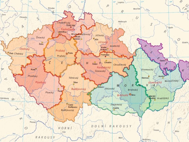
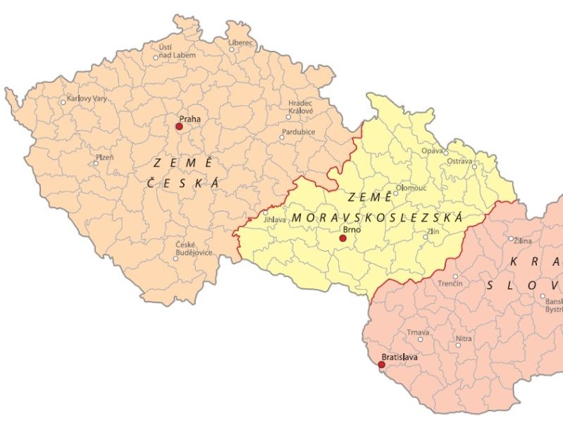
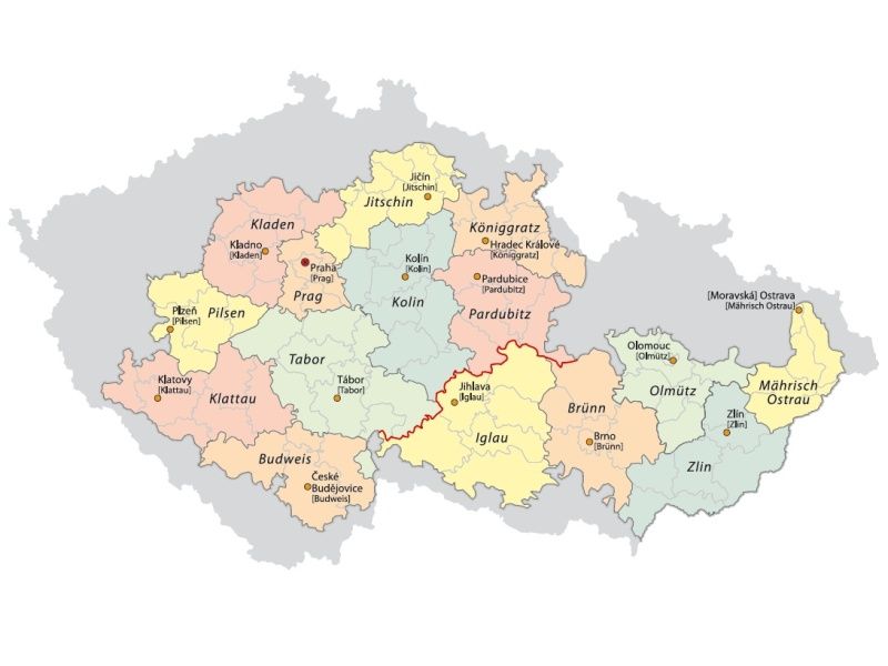
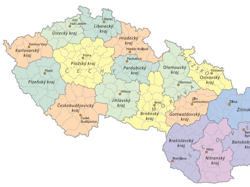
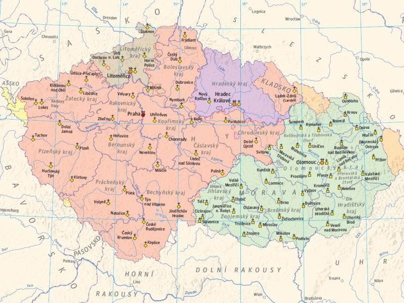
The territorial reach of the individual communities and regions controlled by them has always been delimited by borders, which represent a strong civilizational, historical and geographical variable. Regions of various systems and sizes develop and change within the space and time together with their borders. Their delimitation is affected by the geographical conditions, but above all by the interests of groups with mutual power motivations, strategic, national, economic, cultural and other frequently very specific desires. The issue of the territorial and territorially administrative development is thus extremely complex.
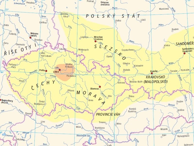
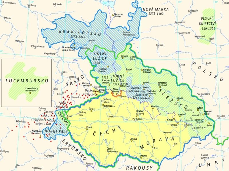
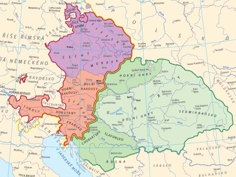
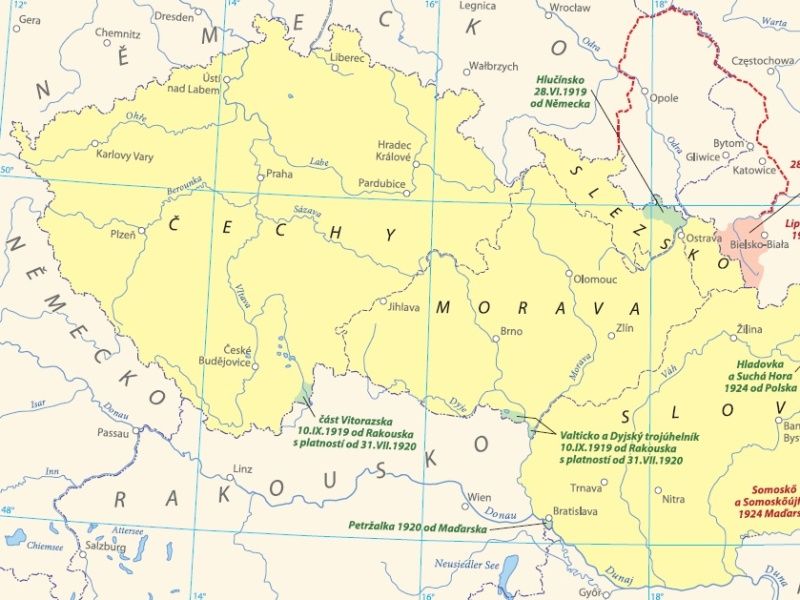
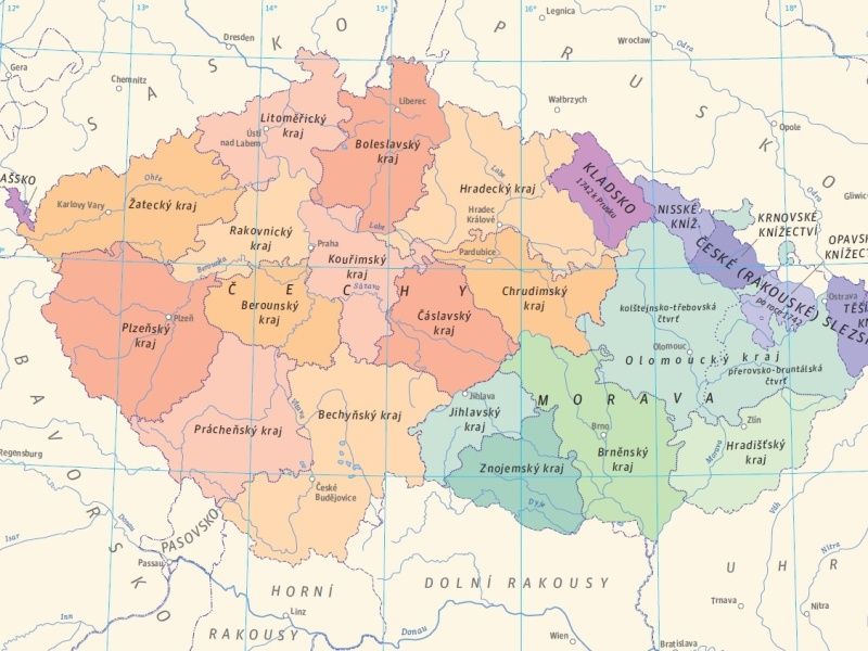
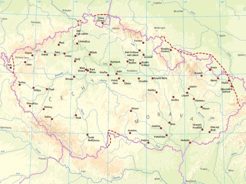
The greatest milestones in the territorial and territorially administrative development of the Czech Lands are turning periods of the Czech and Czechoslovak statehood and the ensuing transformations of the territorial reach and the borders. These periods include the emergence of the Czech state in the 9th and 10th centuries, the Czech state under the last of the Přemyslid dynasty and under Charles IV, incorporation of the Czech Lands into the Habsburg Monarchy in 1526 and collapse of this monarchy (already as Austria-Hungary) in 1918. The temporary demise of our statehood in 1938-1945, the second arrival of totalitarianism in 1948, the strive for a reform in 1968 and above all the return of democracy after 1989 are connected with transformations of the territorial and social circumstances brought about by changes in the territorially administrative arrangements. In total, nine fundamental reforms of territorial administration occurred just at the time of modern administration following 1848. The changing regions and borders became part of the regional identity, often also as regions of historical memory that are reproduced as a part of our cultural heritage.
Semotanová, E.: Mapy Čech, Moravy a Slezska v zrcadle staletí. Praha 2001, 2006.; Dobeš, J.: Dějiny správy v českých zemích: od počátku po současnost. Praha 2005.; Semotanová, E. ‒ Cajthaml, J. a kol.: Akademický atlas českých dějin. Praha 2014, 2. akt. vydání 2016.; Hledíková, Z. – Janák, J. – Dobeš, J.: Dějiny správy v českých zemích: od počátků státu po současnost. Praha 2005
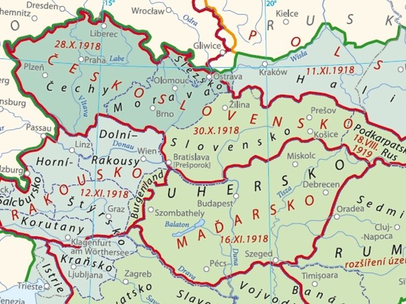
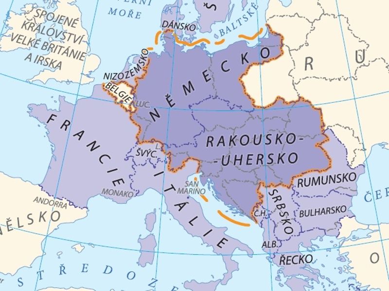
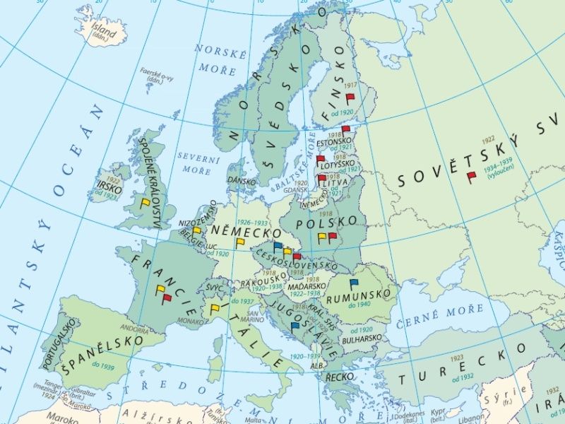
Czech State and Europe in the 20th Century
To some extent, the position of the Czech Lands in Central Europe predetermined the ensuing geopolitical processes. Yet the Czech Lands were frequently important crossroads of political interests and conflicts. For Czechoslovakia, Poland and Hungary, the disintegration of Austria-Hungary and emergence of the successor states at the end of World War I symbolized fulfilment of their effort to gain independence. Simultaneously, however, the post-war arrangement of the world and Europe concealed many risks that culminated in another war (1939 ‒ 1945) and division of the continent into new political interest zones after 1945 and again at the end of the 1980s. Central Europe has always been a space where the West met the East and where the European as well as non-European structures desired to include some of the Central European countries into their power blocks. The geopolitical aspects formed and still form mutual relations between the European states where the Czech Lands still present a sensitive deciding factor in international stability.
Semotanová, E.: Historická geografie českých zemí. Praha 2002, 2006;Semotanová, E. Zudová-Lešková, Z. ‒ Močičková, J. Cajthaml, J. ‒ Seemann, P. ‒ Bláha J. D. a kol.: Český historický atlas. Kapitoly z dějin 20. století. Praha 2019.
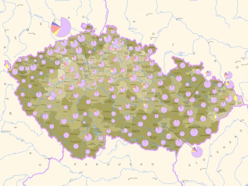
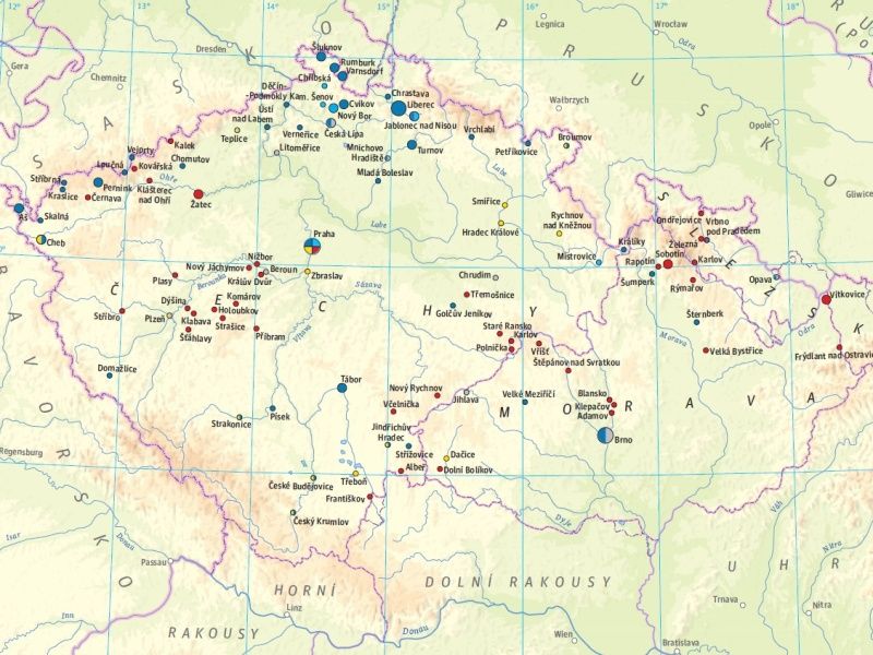
Populations
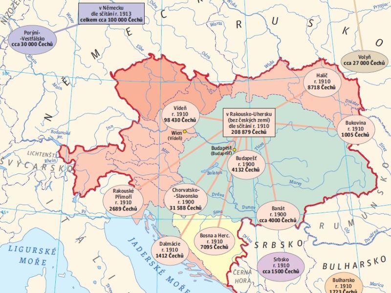
This section monitors the development and transformations of the Czech population from the Middle Ages until the early 21st century from several perspectives. It is concerned with demographic and ethnic issues, monitors important migration processes, Czech traces in foreign countries, development of the educational system, and results of parliamentary elections throughout the 20th century. All of these mentioned processes were mutually related, mingled, and fundamentally affected the formation of the Czech society. They form important pieces in the mosaic of our present national identity.
The Czech Lands were characterized by long-lasting coexistence of the Czechs and Germans, but also the Jews since the Middle Ages. The ethnic issue became particularly crucial in the 19th century when it fundamentally affected events in society. In the 20th century, it grew into tragic proportions during the Second World War and the subsequent forced displacement of the German population from Czechoslovakia.
As regards the migration processes, attention is paid to the most important forced or voluntary migration waves, which were motivated by religion, politics, or socio-economic aspects. Let us remember the non-Catholic exile in the post-White Mountain period, escapes of the Jews from the Nazi persecution or emigration of the Czechoslovak citizens after the 1968 occupation.
In the 19th and 20th centuries, many citizens voluntarily left the Czech Lands in search of a better future and happiness in various parts of the world. Their traces are still evident in the world and create independent “Czech islands” proudly representing the Czech roots, culture, and traditions. Also the Czech travellers, scientists, doctors, artists, soldiers, or entrepreneurs left their traces behind in various places of our planet. Their deeds are commemorated by numerous monuments, buildings, and works of art, but in some cases, they are also reflected in the geographic terminology.
The educational process has been monitored since the 18th century. Attention is paid to the gradual development of Czech secondary and university education and academia until the present day.
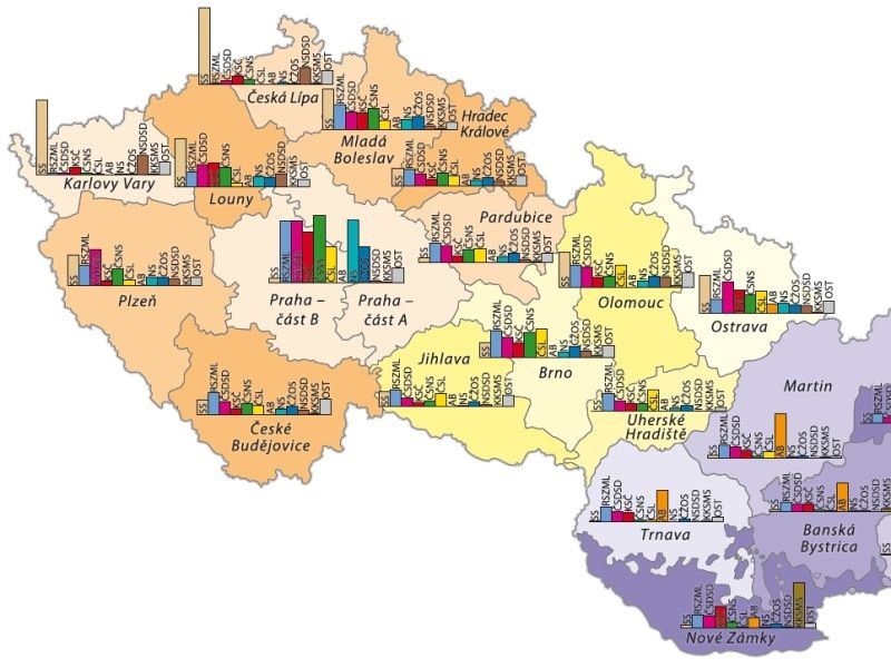
The results of the parliamentary elections outline the development of the political system in Czechoslovakia and the Czech Republic and the transformations of political preferences of the population throughout the 20th century. They evoke reflections on how the citizens coped with their roles of active co-creators of the political events, how they were affected by various political ideologies, but also how they managed to adapt themselves to the return of democracy after forty years of communism when the elections were just a formal act.
Maur, E. a kol.: Dějiny obyvatelstva českých zemí. 2. vyd. Praha 1998; Semotanová, E. ‒ Cajthaml, J. a kol.: Akademický atlas českých dějin. Praha 2014, 2. akt. vydání 2016.; Semotanová, E. Zudová-Lešková, Z. ‒ Močičková, J. Cajthaml, J. ‒ Seemann, P. ‒ Bláha J. D. a kol.: Český historický atlas. Kapitoly z dějin 20. století. Praha 2019.
Religion and Faith
Along with the language, religion is perceived as one of the key elements of cultural diversity in the world. It is defined by the expression of life experience and the related behaviour and conduct based on the belief in the existence of a God or gods, symbols of something transcendent. Religion strongly affects the world-view system, the scale of values and the political, demographic and socio-economic development of the regions. This is why it has played somewhat contradictory role in the history of the mankind and the nations, standing at the birth of many clashes and conflicts – no religion exists in isolation from the other religions. Nonetheless, all religions contain a potential for legitimisation of violence as well as peaceful coexistence.
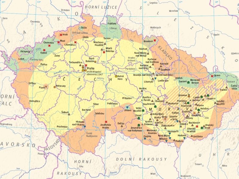
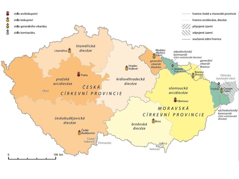
Since antiquity, the European space and thus the Czech Lands have been a ground for the meeting and fragmentation of religious and philosophical attitudes thanks to their geopolitical position and cultural diversity. This fact led to a series of reformatory ecclesiastical movements and activities of minority religious movements as it is documented in the part dedicated to the religious faiths.
The Czech Lands are traditionally connected with activities and dominance of the Roman Catholic Church, which is therefore the centre of interest in the part aimed at ecclesiastical administration. Moreover, the transformations in this ecclesiastical administration reflect the development of the residential structures and importance of the individual regional culture centres.
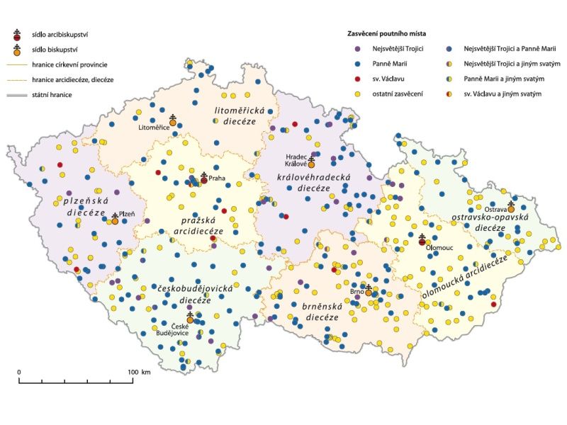
All world religions are characterized by pilgrimages to the sacred sites as a proof of interconnection of the time, space and faith and as a part of the experienced cultural tradition. Some of these sacred sites are visited at a greater extent and are thus referred to as “pilgrimage sites”. Their important role cannot be forgotten in the cultural landscape where the sacral objects often bear witness to the life of the community, also chronologically, when the original settlement has vanished. Maps in the last subchapter are thus dedicated to the pilgrimage sites.
Boháč, Z.: Atlas církevních dějin českých zemí 1918–1999. Kostelní Vydří 1999; Bowker, J. (ed.): The Oxford dictionary of world religions. Oxford 1999; Lane, T.: Dějiny křesťanského myšlení. Praha 1999; Lužný, D.: Posvátná země – místo náboženského soužití nebo konfliktů?, Geografické rozhledy 29, č. 3, 2020, s. 16–19; Schulze Wessel, M. – Zückert, M. (eds.): Handbuch der Religions- und Kirchengeschichte der böhmischen Länder und Tschechiens im 20. Jahrhundert. München 2009; Suchánek, D. – Drška, V.: Církevní dějiny. Antika a středověk. Praha 2013; Suchánek, D. – Drška, V.: Církevní dějiny. Novověk. Praha 2018.
Historical Milestones, Periods and Consequences
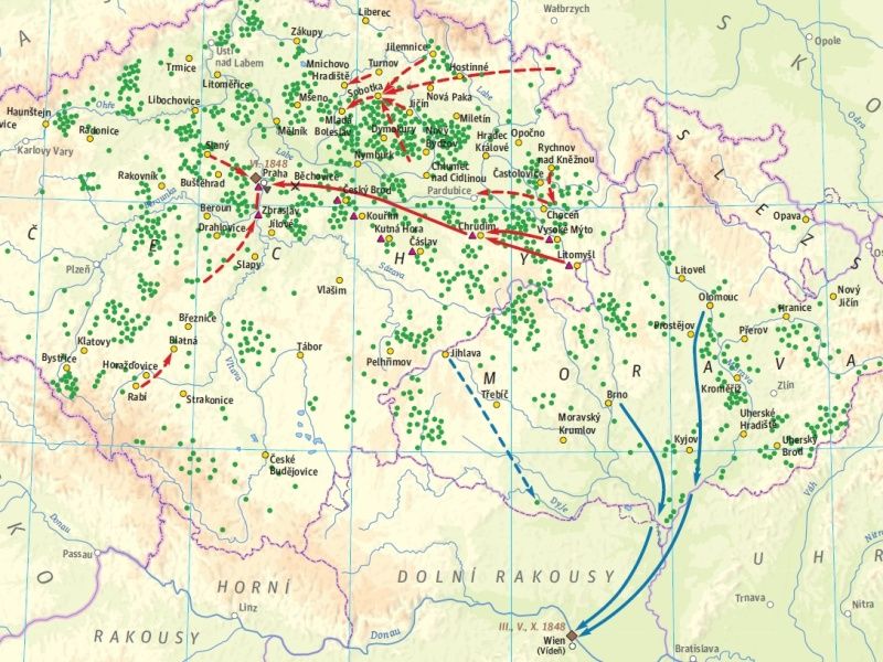
The long 19th century brought about a shift from servitude to citizenship, from absolutism to constitutionalism, from agrarian society to industrial society and new civilizational trends. The historical milestones traditionally include military and political history. The revolutionary years of 1848/1849 brought a significant turning point in the political, economical and social development of the Czech Lands, the Habsburg Monarchy and the whole of Europe.
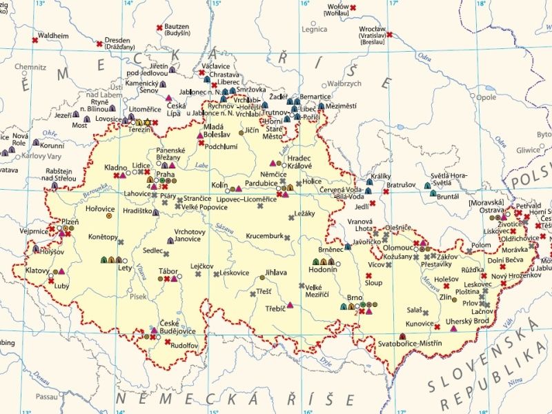
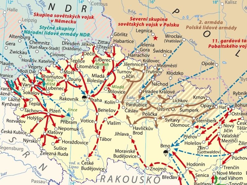
The modern 20th century history was an epoch in the shadow of both world wars that heavily affected it. The disintegration of the Austro-Hungarian Empire in 1918 resulted in the emergence of new successor states including the Czechoslovak Republic. The Nazi aggression against Czechoslovakia at the end of the 1930s resulted in the Second World War. It brought Nazi aggression and resistance against it to the Czech Lands. After the defeat of Germany in 1945, the Czechoslovak independence was re-established and the war criminals were punished. However, the aggressive seizure of power by the communists in the form of a communist coup in February 1948 caused another reversal, which buried Czechoslovak parliamentary democracy for more than 40 years. The ease in the society at the end of the 1960s was broken by intervention of the Warsaw Pact armies in 1968 and arrival of the so-called normalisation. The growing resistance against the communist regime culminated in the Velvet Revolution in 1989 and return of the democratic system.
Dejmek, J. a kol.: Československo. Dějiny státu, Praha 2018;
Gebhart, J., Kuklík, J.: Velké dějiny zemí Koruny české, sv. XVa., XVb., Praha 2005, 2006;
Kárník, Z.: České země v éře První republiky, díl I-III, Praha 2017-2018;
Semotanová, E. ‒ Cajthaml, J. a kol.: Akademický atlas českých dějin. Praha 2014, 2. akt. vydání 2016;
Seemann, P. – Bláha, J., D. a kol.: Český historický atlas. Kapitoly z dějin 20. století. Praha 2019
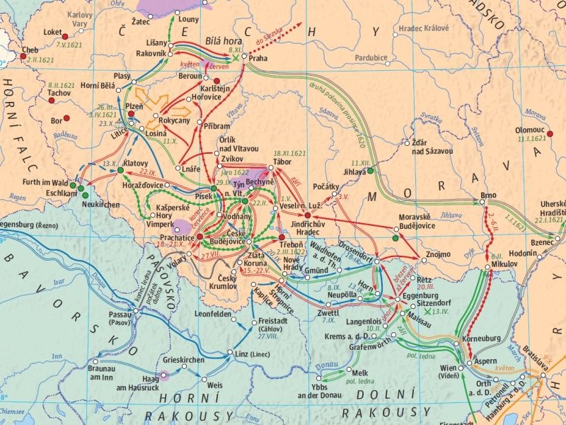
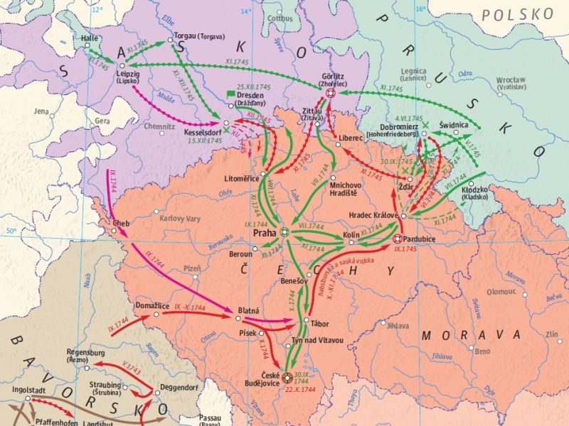
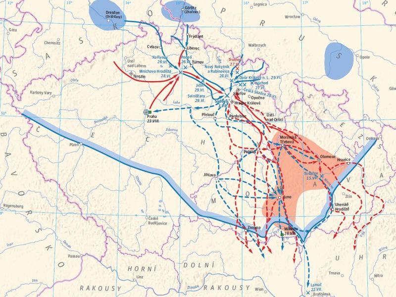
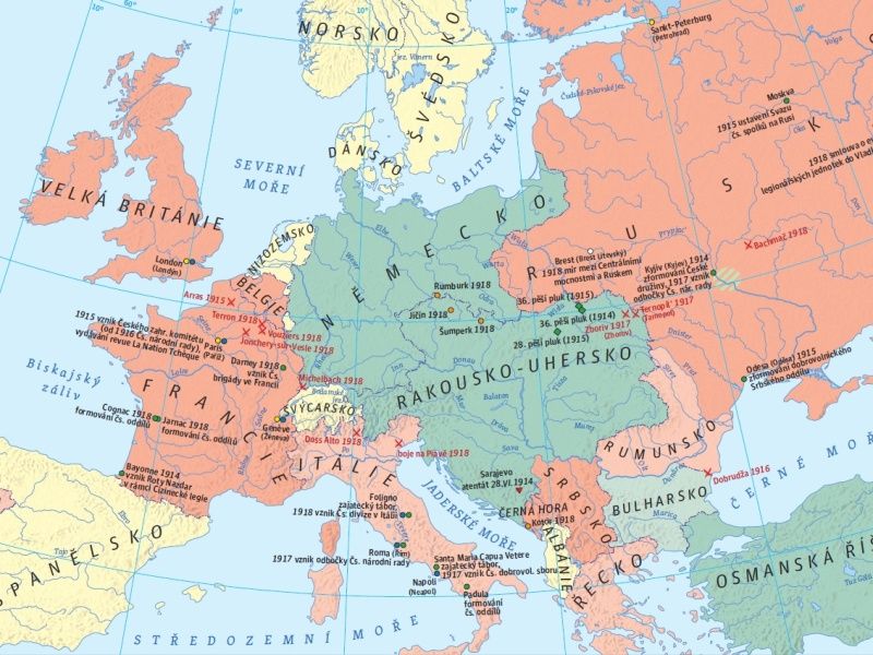
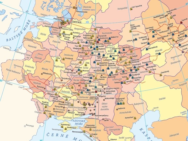
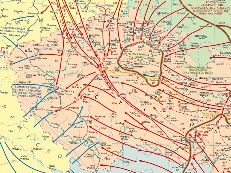
War conflicts and their consequences
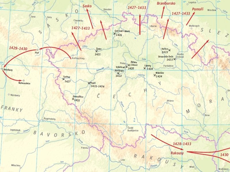
The military and the maps make a significant “alliance” in particular during the wars – in preparations to their strategically long-term objectives and the overall idea of the planned military operations and in the use of tactical methods in each war. This is because the simplified map illustrations of the attacked (but also defended) ground represent navigation aids, which point at the relations between its objects. This situation often heavily affected the war logistics and thus the final outcome. From the 15th century to the 20th century, this “alliance” experienced a huge development as regards the form and contents. The outcome is the understanding that for the military “clash of the wills” presented as interaction between two or more military forces, maps of various types (i.e. military topographic maps of various types and special focus, specific maps, the so-called atypical maps such as planimetric maps, aerial maps, photo mosaics or map graphics of joint air-ground operations) are extremely important. Cooperation between historians, geographers and cartographers (and thus the history, historical geography, interdisciplinary historiography exploring transformations of geographic space in the time, historical cartography, interdisciplinary disciplines dealing with the processing of historical events and processes on the maps) has always been important for the development of military maps per se, but also for the understanding of the facts and contexts of the wars and their consequences as the permanent components of the human history, mainly in the form of reconstruction maps such as the Wars and their Consequences, which are the results collective sets of findings on wars against the Hussites, battles of the Thirty Year War and wars for the Austrian and Bavarian heritage on the Czech territory. Similarly, a complex view of the complicated 20th century burdened with the wars is presented, based on detailed analytic probes into complicated and hitherto unprocessed themes of the First World War and Second World War (e.g. the POW camps).
Clausewitz, C. von: On War. Princeton 1976; Heřtová, Y.: Zákopová válka. Praha 2008; Hrbek, J. – Smetana, V. a kol.: Draze zaplacená svoboda: Osvobození Československa 1944–1945. Praha 2009.; Sutor, B.: Od spravedlivé války k spravedlivému míru?, Praha 2014.; Semotanová, E. – Zudová-Lešková, Z. ‒ Močičková, J. Cajthaml, J. ‒ Seemann, P. ‒ Bláha J. D. a kol.: Český historický atlas. Kapitoly z dějin 20. století. Praha 2019
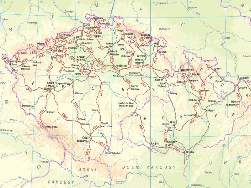
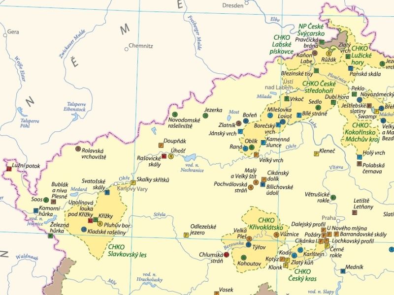
Landscape and Humans
The man has always heavily changed the landscape with his activities. The landscape was affected by the advancing urbanisation – the emergence of towns, which started on our territory in the 13th century and which resulted in the form of large urban areas in the 20th century. Agricultural production, originally based on the three-field system, gradually developed into agro-industrial complexes in the second half of the 19th century. The form of the present landscape was most heavily formed by the socialist industrialisation, i.e. collectivization of the farms accompanied by massive land consolidation and removing valuable landscape structures. The landscape was also transformed by the road infrastructure, artificial lake dams supplying water to the growing industrial production, intensive agriculture and potable water for the urban population. The advancing urbanization and industrialisation from the turn of the 19th and 20th centuries inspired the need to return to open countryside, relax in it and protect it together with the created cultural values for the future generations.
Semotanová, E. ‒ Cajthaml, J. a kol.: Akademický atlas českých dějin. Praha 2014, 2. akt. vydání 2016.; Semotanová, E. Zudová-Lešková, Z. ‒ Močičková, J. Cajthaml, J. ‒ Seemann, P. ‒ Bláha J. D. a kol.: Český historický atlas. Kapitoly z dějin 20. století. Praha 2019.
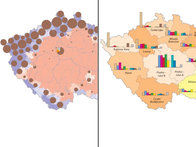
Map compare
The last chapter allows you to compare two selected topics across the Czech Historical Atlas portal. This individual selection can serve the user to independently discover parallels and connections in the historical development of the Czech state.
You can select a map for a given half of the screen in the drop-down menu. In the Free compare tab you can open and compare any maps (except the maps from chapters 6 and 7). Selected maps can be viewed in the Synchronized compare tab with the synchronized shift of both windows in different scales.