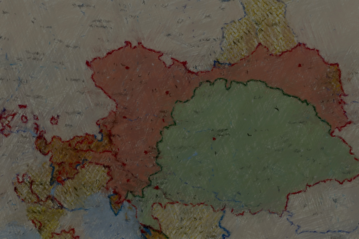
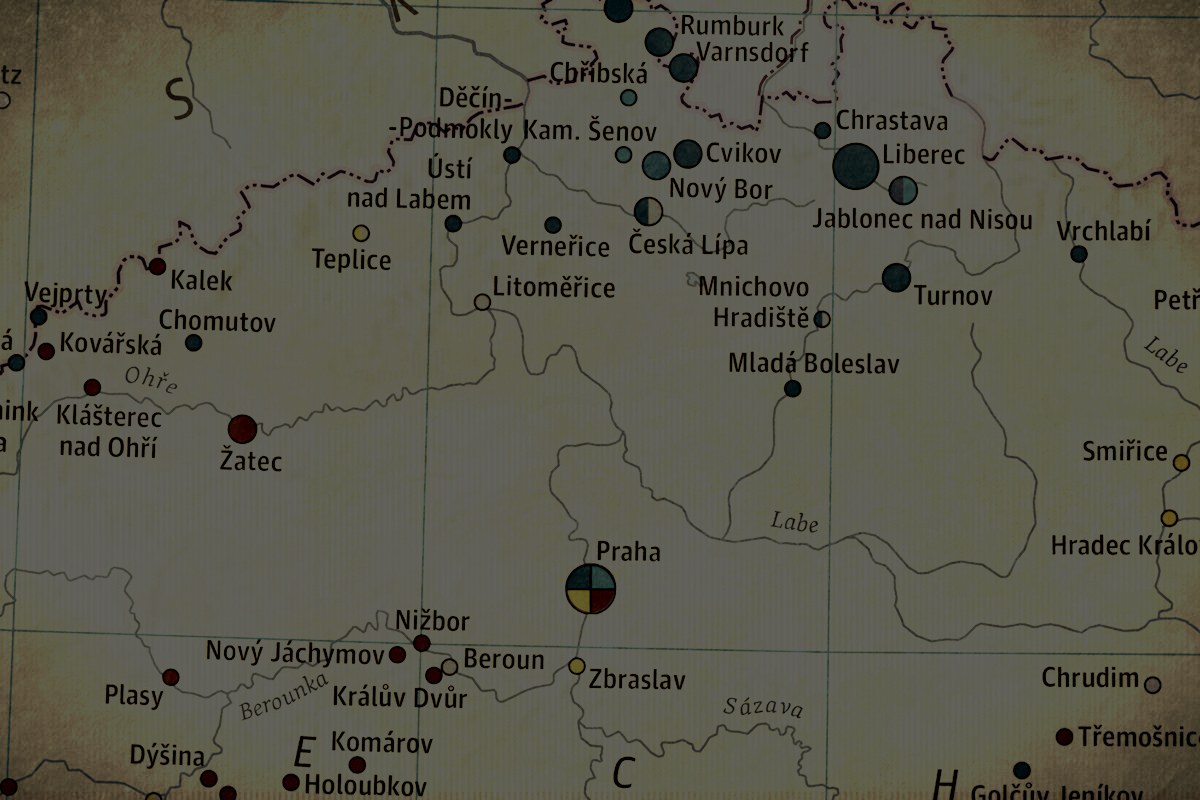
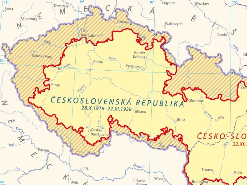
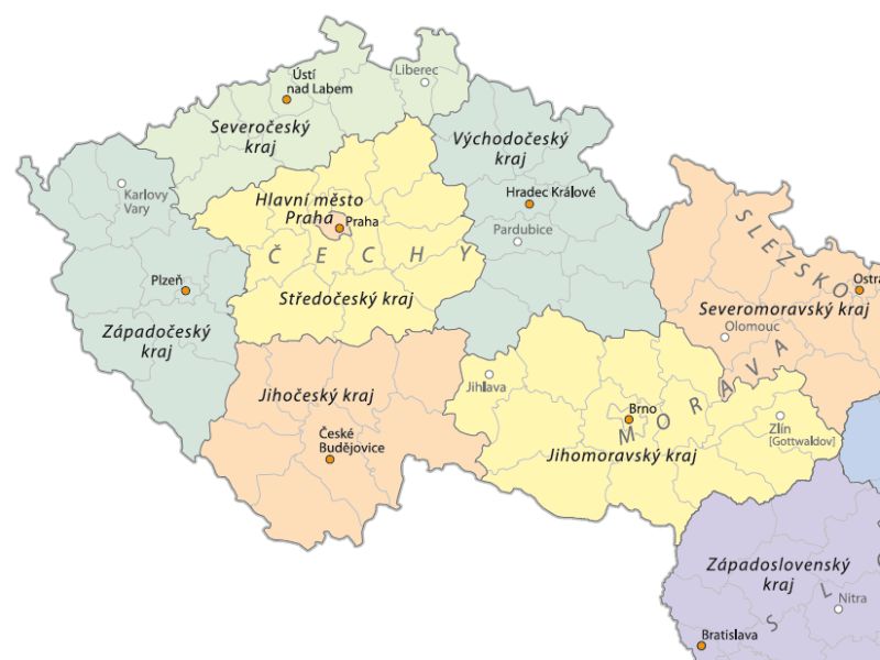
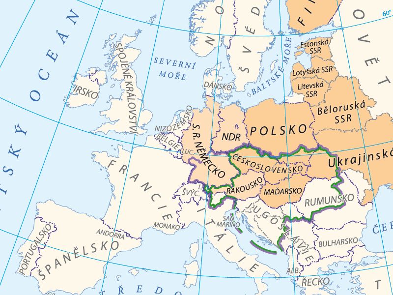
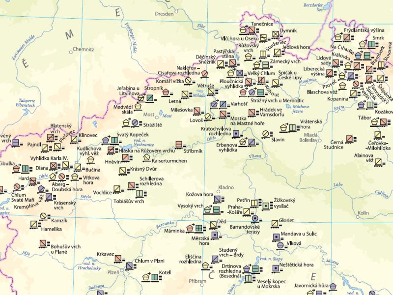
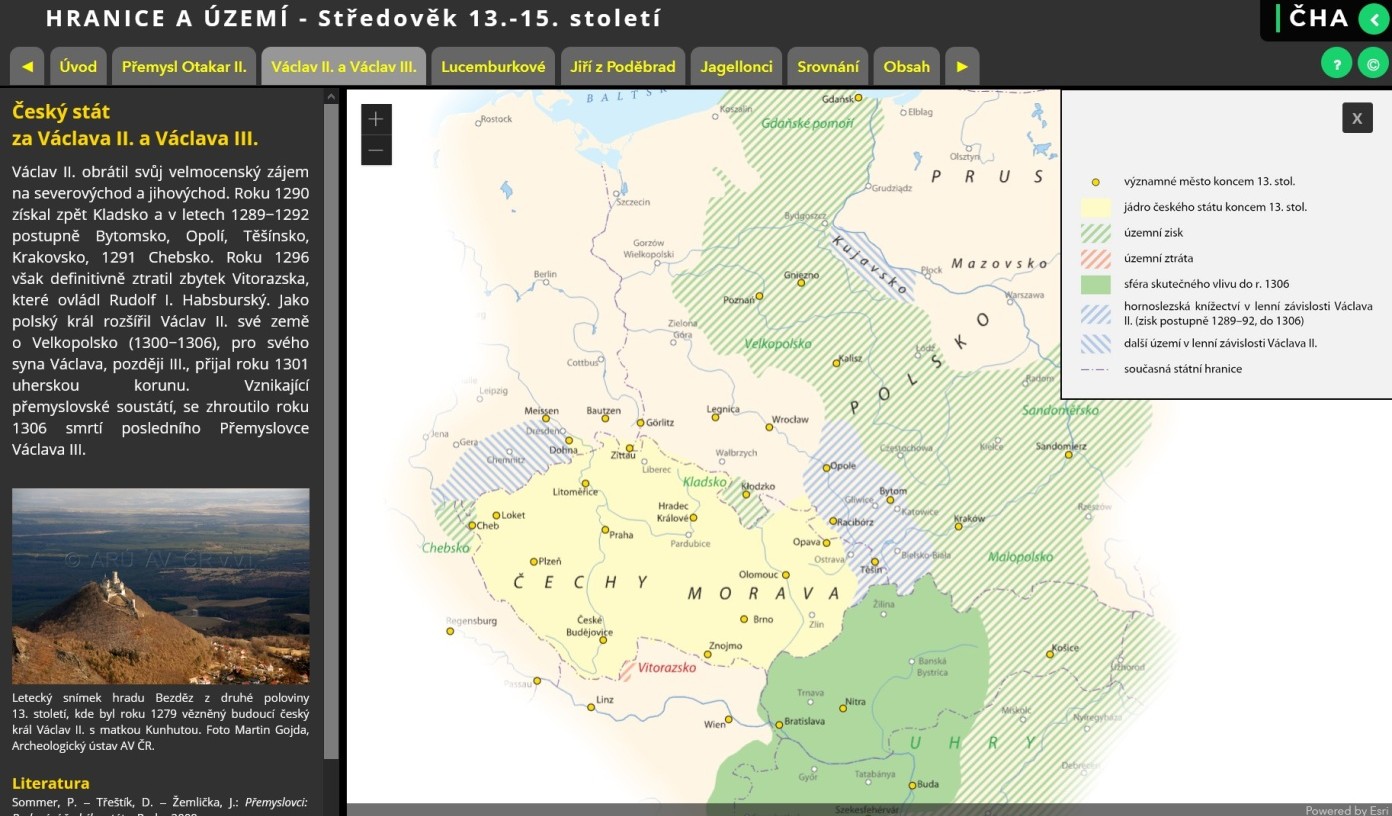
The Space theme is connected with the delimitation of the territories and incorporation of the Czech Lands, Czechoslovakia, and the Czech Republic within the central European and international structures. Space also includes sectioning of the landscape into smaller units where transformations provoked by various causes took place in the development of the society.
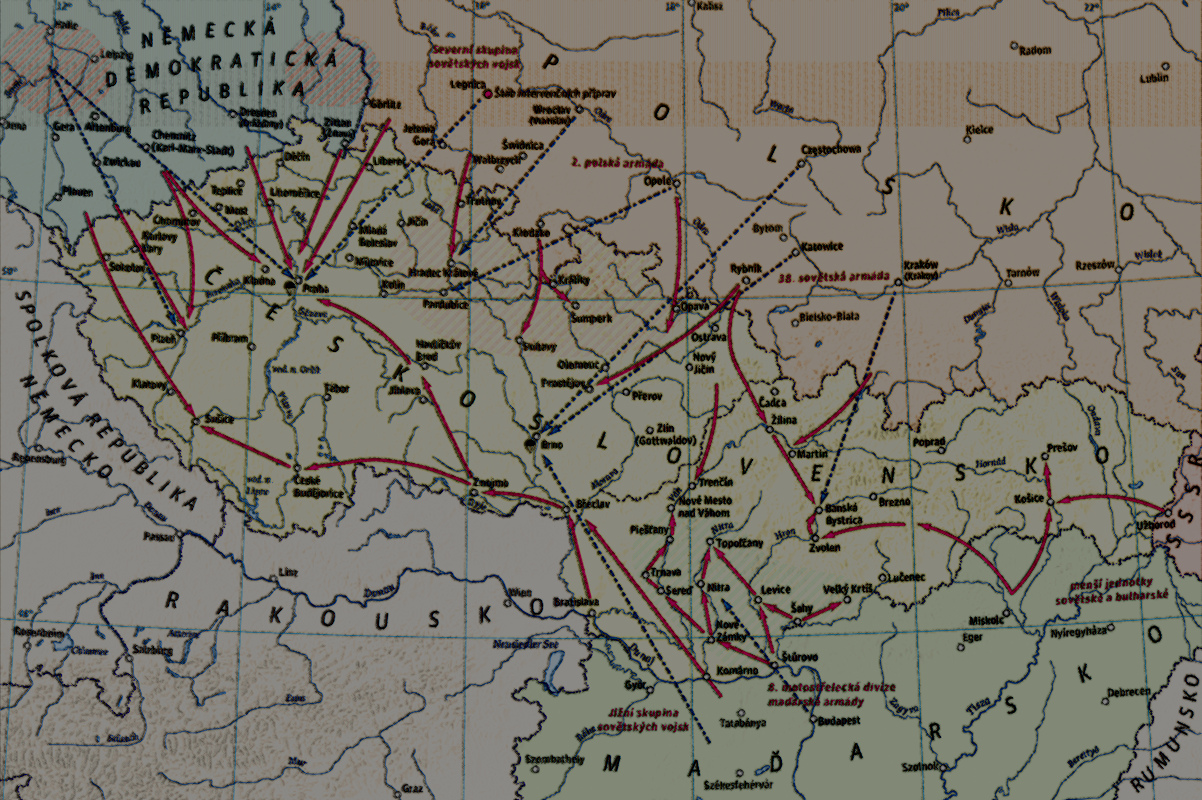
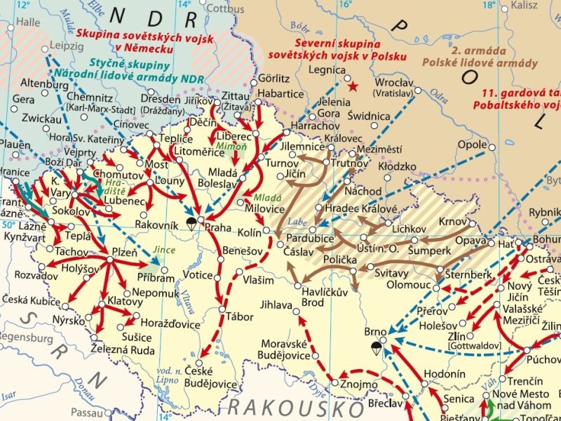
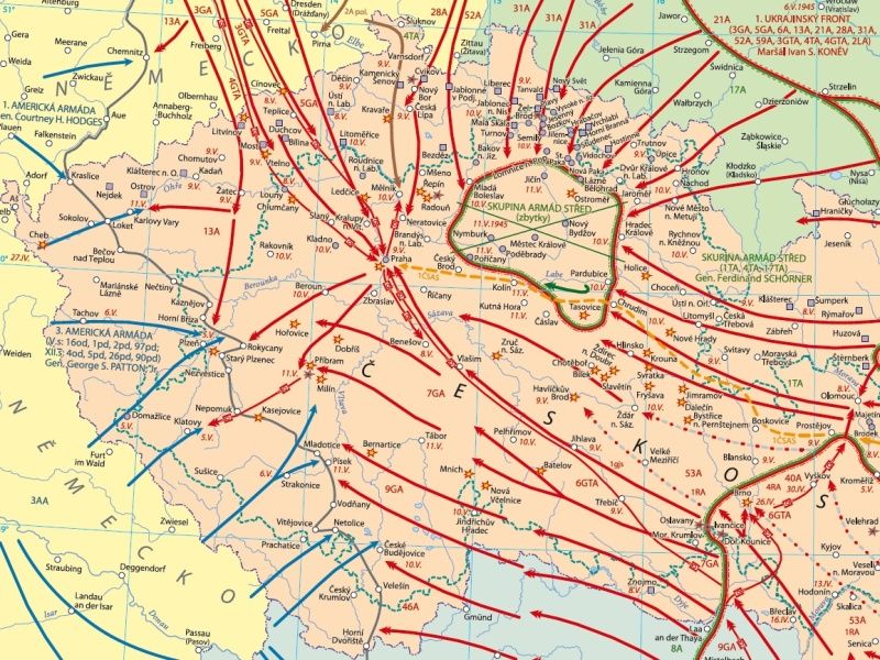
The Time theme mostly covers military and political history. Apart from the historical developments taking place on large European and non-European territories, it also includes events concentrated to a few repetitive locations or rapid transformations in the society over short periods of time.
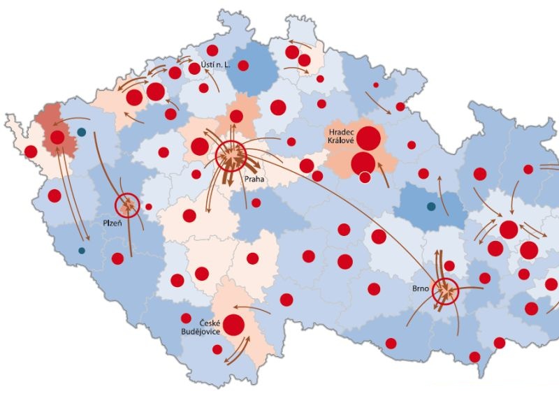
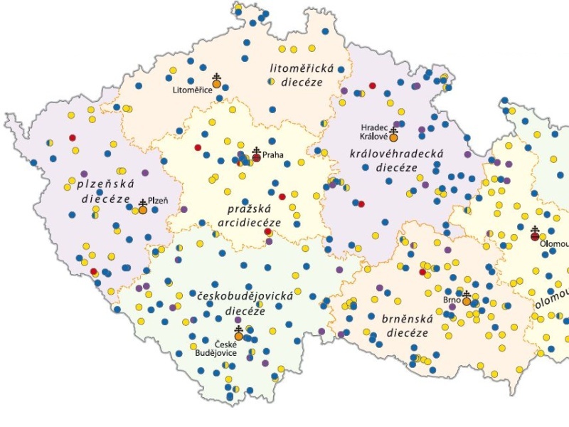
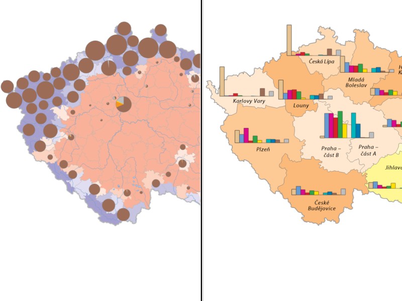
The Society theme reflects on the still hot issue of migrations, both as a historical process and as a demonstration of violence of the ruling powers and regimes. It pays attention to the ethnic, religious, and educational diversities and monitors the perception of the Czech State in the world through various forms of representations as a whole or as regards the individual persons.
About the project
The Czech Historical Atlas is a project of applied research into the national and cultural identity (NAKI II) of the Ministry of Culture, ID No. DG16P02H010, for the years 2016‒2020. It follows up cooperation between the Institute of History CAS and the Department of Geomatics at the Czech Technical University in Prague Faculty of Civil Engineering in the area of historical atlas cartography implemented within the Academic Atlas of the Czech History (2014, 2016; awarded the Magnesia Litera of 2015) and other historical geographic works. It adheres to the Research, development, and innovation Priorities 3.2 National, regional and local identity and tradition and 3.2.1 Knowledge of history as a precondition to the preservation and cultivation of national, regional and local identity, memory and tradition in the national context.
The following two major projects have been carried out within the project Electronic map portal a Printed Historical Atlas
Both the first and second map collections are supplemented with textual comments and illustrations. The project included workshops on theoretical and methodological problems connected with the creation and publication of historical maps and the team members published numerous papers and participated in specialized conferences on atlas cartography, both printed and electronic.
Electronic map portal
Electronic map portal Czech Historical Atlas on click-through dedicated to the Czech and Czechoslovak history in the international context, created as a website map application using the most advanced GIS technologies. It opens unique access to pupils and students in a way that has not been achieved in the Czech Republic so far. Electronic historical atlases accessible on the Internet are in high demand in the Czech Republic. Despite this fact, however, there were only foreign Internet atlases, which inform about the Czech and Czechoslovak history very cursorily and often distortedly and the partial historical maps by frequently non-professional authors often contain contradictory information. The Czech Historical Atlas portal presents historical sciences in the context of modern cartography, thus contributing to the preservation of national memory and the formation of historical awareness in the society.
Colophon

Printed Historical Atlas
Printed Czech Historical Atlas. Chapters on the 20th-Century History, Prague 2019 . It contains historical maps with historically important and attractive themes in particular in the 20th century, deepening the contents of the Academic Atlas of the Czech History with emphasis on hitherto unprocessed issues. It presents cartographically depicted historical events still attractive to the professionals as well as non-professionals. It offers an overview of the historical developments in time and space facilitated by printed (analogue) and synthetic maps with a certain degree of stationariness, but at the same time with the benefit of stability of the printed media compared to the Internet. The basic element of the printed atlas is a map with a specialized content (Nmap) Collection of Historical Maps to the 20th-Century Czech History.
FACTS
Facts about map portal
Maps
Map applications
Images
Chapters