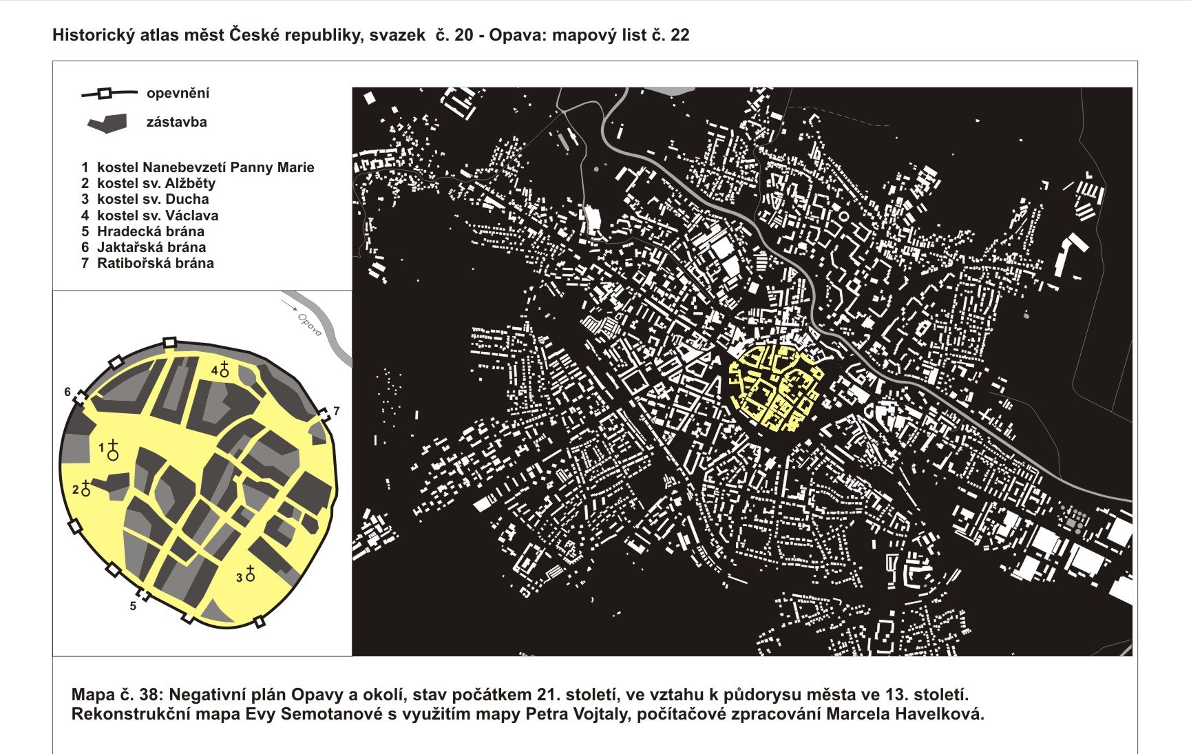

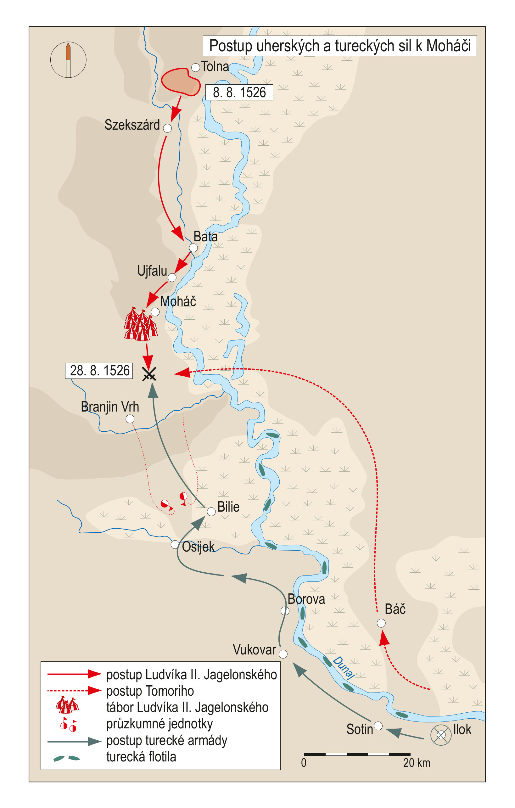
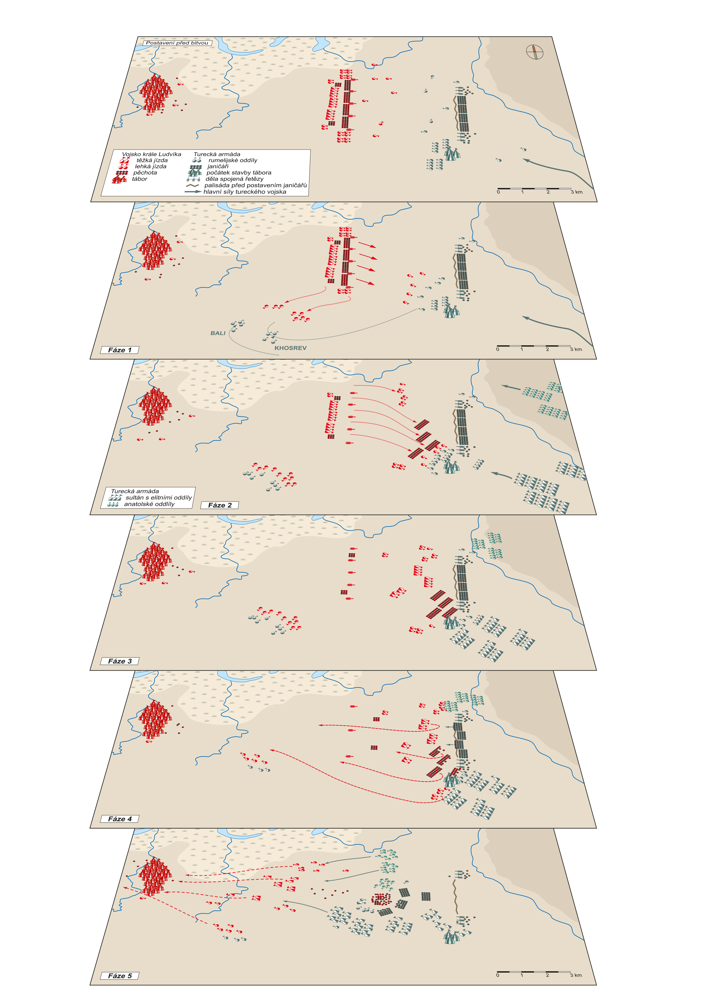
Borders and Territories
In historical cartography and historical geography, the territories and state borders represent one of the fundamental issues. Historical maps and atlases depict borders and their delineations also in relation to the development of regions and regional identities. In the societies, there have always been conflicts between the communities; new borders emerge continuously only to vanish again or change after time. The borders have been accompanying the man since his first steps on the Earth. Historical and present borders cover the entire surface of the Earth in imaginary layers. Whether real or imaginary, they are omnipresent. They can be found in the space, in documents, maps, illustrations, but also in the human minds. They form barriers by which the societies defined (and still define) themselves, based on various ideas, ideologies and special-interest or controlled landscapes. For centuries, the man has modelled the size and face of “his” space. The fight for survival was replaced with a desire to penetrate into unknown landscapes, take them, settle in them and cultivate them by means of utmost exploitation. If the man succeeded, he delimited the acquired territory with real as well as mental borders. From where to where? This was the common question that the people asked in their homes but also in more distant places that they knew well or were just getting to know. From where to where did the land perceived by the mythical Grandfather Čech extend? From here over to there, his descendants used to answer, decided to penetrate into the new territories, own them and use them. The borders have always been an inseparable part of the life of the society. A glimpse into their mingling and overlapping across the centuries opens philosophical reflections on the permanence of human interests, goals and desires, justification of annexing foreign territories, relativity of the words “permanent” and “stable”, “definitive” or “forever” mainly as regards ideologies of totalitarianism. Yet it is clear that the borders have always expressed express a respected and socially significant civilizational, historical and geographical value connected with the awareness of protection and safety of the delimited territory..
Eva Semotanová
Subchapters:
- Medieval Times until 12th c.
- Medieval Times 13th - 15th c.
- Early Modern Period
- Modern Period until 1918
- Modern Period since 1918
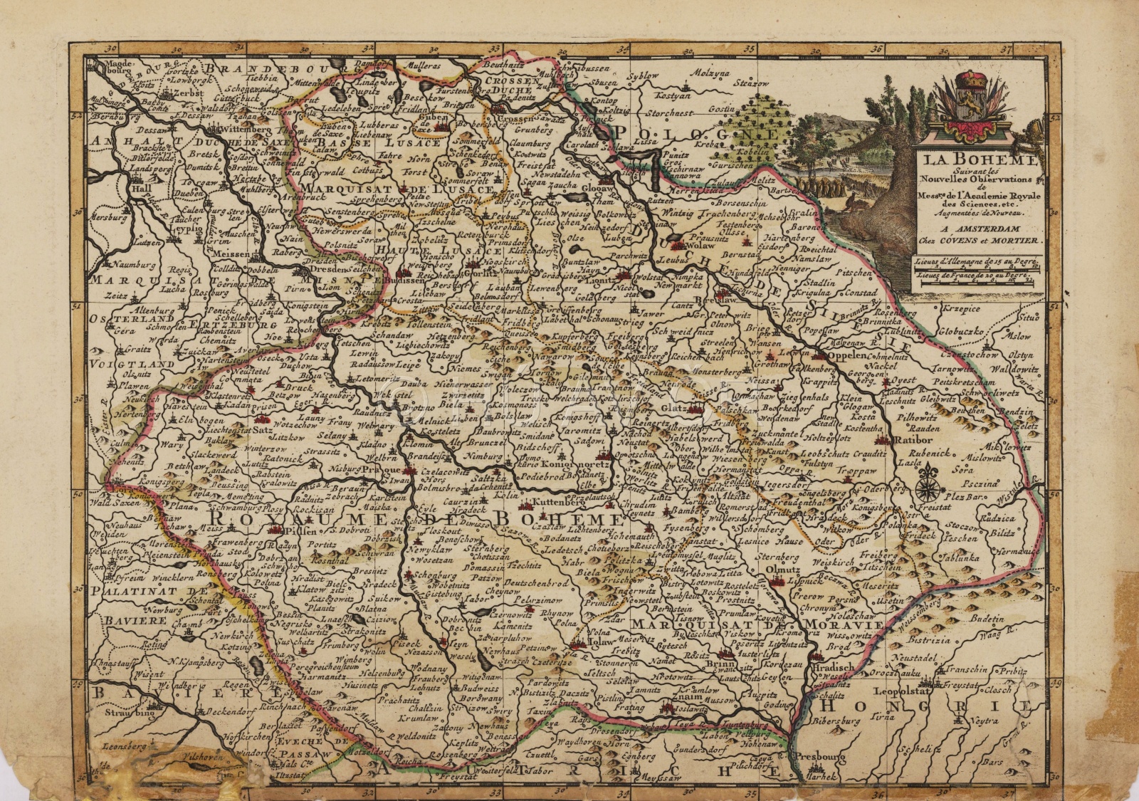
Map fo the Lands of the Bohemian Crown, La Boheme, issued in Amsterdam at Covense and Mortier after 1721. The boundaries are only schematical. The map shows the situation before 1635, when both Upper and Lower Lusatia were part of the Bohemian Crown, and at the same time before 1742, before most of Silesia and Kladsko region were lost in the Silesian Wars. Map Collection of the Institute of History, CAS. Map display
Authors
historians: Tomáš Burda, Zdeněk Měřínský, Jan Němeček, Eva Semotanová, Aleš Vyskočil, Josef Žemlička
cartographers: Tomáš Janata, Jiří Cajthaml, Petra Jílková, Pavel Seemann
digital atlas: Petra Jílková, Jiří Krejčí, Jitka Močičková, Eva Semotanová
team of authors
References
Semotanová, E.: Historická geografie českých zemí. Praha 2002, 2006;
Semotanová, E. (ed.): Hranice v krajinách. Praha 2020.
Related chapters:
BORDERS and REGIONS
- Medieval Times 11th - 13th c.
- Regional System until 1850
- Regional System since 1850
- Administration 1918-1938
- Administration of Protectorate
- Administration since 1945