Czechoslovak combat units in the Second World War
Following the Munich Agreement on 30 September 1938 and especially after 14 March 1939, Czechoslovak citizens were leaving their country to fight for its freedom and restoration behind the borders. The bases for these objectives were the still operating Czechoslovak embassies, in particular the French embassy where an agreement to establish the Czechoslovak Army was reached on 2 September 1939. Its soldiers fought throughout the war against the German Reich and its satellites on the side of the Allies on three continents. The Czechoslovak troops fought the Nazis in Poland and in separate Czech and foreign units in France, the United Kingdom, on the territory of Palestine and in the Soviet Union. The estimated losses of Czechoslovak soldiers caused by the fights and Nazi repressions are 12,000 to 15,000.
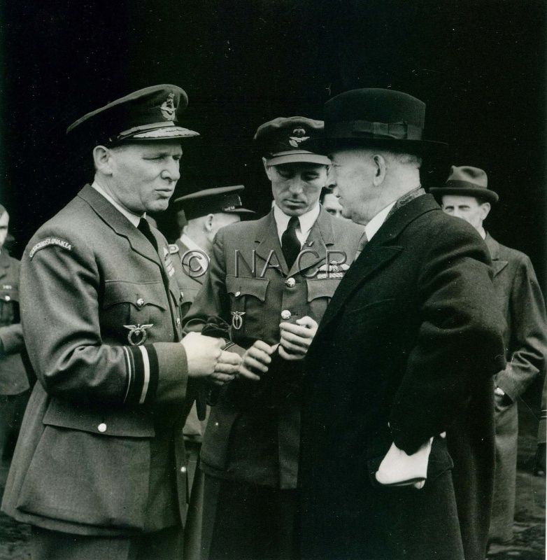
Since October 1938, Edvard Beneš promoted Czechoslovak resistance activities abroad, realising the importance of Czechoslovak soldiers. The president in an interview with Czechoslovak airmen (from the left) Gen. Karel Janoušek, commander of the Czechoslovak air force units in the Royal Air Force and Wing Commander Jaroslav Hlaďo, commander of the No. 312 Czechoslovak Squadron RAF on 20 September 1944. The National Archives, Prague
References
Pecka, J.: Na demarkační čáře. Americká armáda v Čechách 1945. Praha 1995;
Čejka, E.: Československý odboj na Západě (1939-1945). Praha 1997;
Zudová – Lešková, Z. a kol.: Československá armáda 1939 – 1945 (Plány a skutečnost). Praha 2002;
Cséfalvay, F. a kol.: Vojenské dějiny Slovenska, zv. 5. Bratislava 2008;
Hrbek, J. – Smetana, V. a kol.: Draze zaplacená svoboda: Osvobození Československa 1944–1945. Praha 2009;
Semotanová, E. ‒ Cajthaml, J. a kol.: Akademický atlas českých dějin. Praha 2014, 2. akt. vydání 2016.

This work is licensed under a Creative Commons BY-NC-ND 4.0
Slovak National Uprising
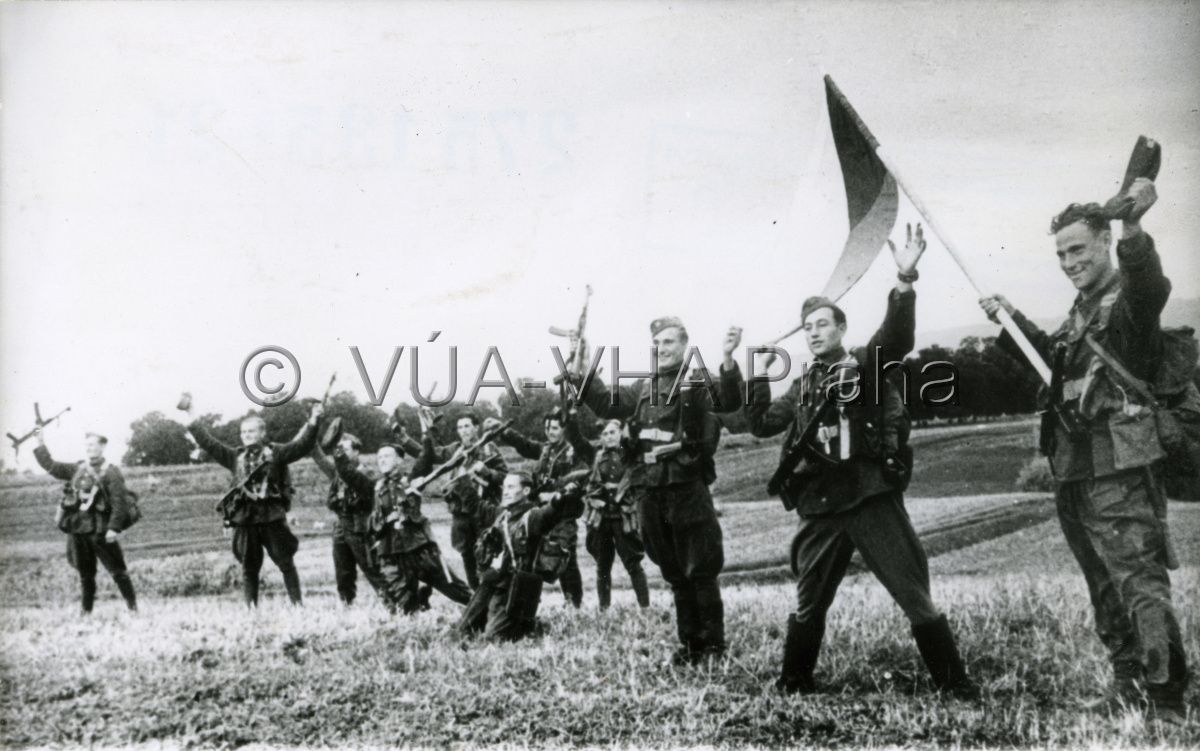
The Slovak National Uprising that took place between 29 August and 27 October 1944 was the result of internal development in Slovakia since 1939 and preparations of the domestic democratic resistance following instructions of the London Czechoslovak Government in Exile and the communist resistance that fulfilled orders of Czechoslovak communists in Moscow. The immediate impulse to the Slovak National Uprising arrived with occupation by the German army on 29 August 1944. The political leadership and military command of the main armed force, i.e. the 1st Czechoslovak Army in Slovakia led by generals J. Golian and R. Viest with 60,000 soldiers and 18,000 partisans, concentrated in Banská Bystrica. The heaviest fights took place at Strečno, Martin – Vrútky, Čremošné, Ružomberok, Telgrát, horní Nitra, Hronská Dúbrava, Badín and Banská Štiavnica.
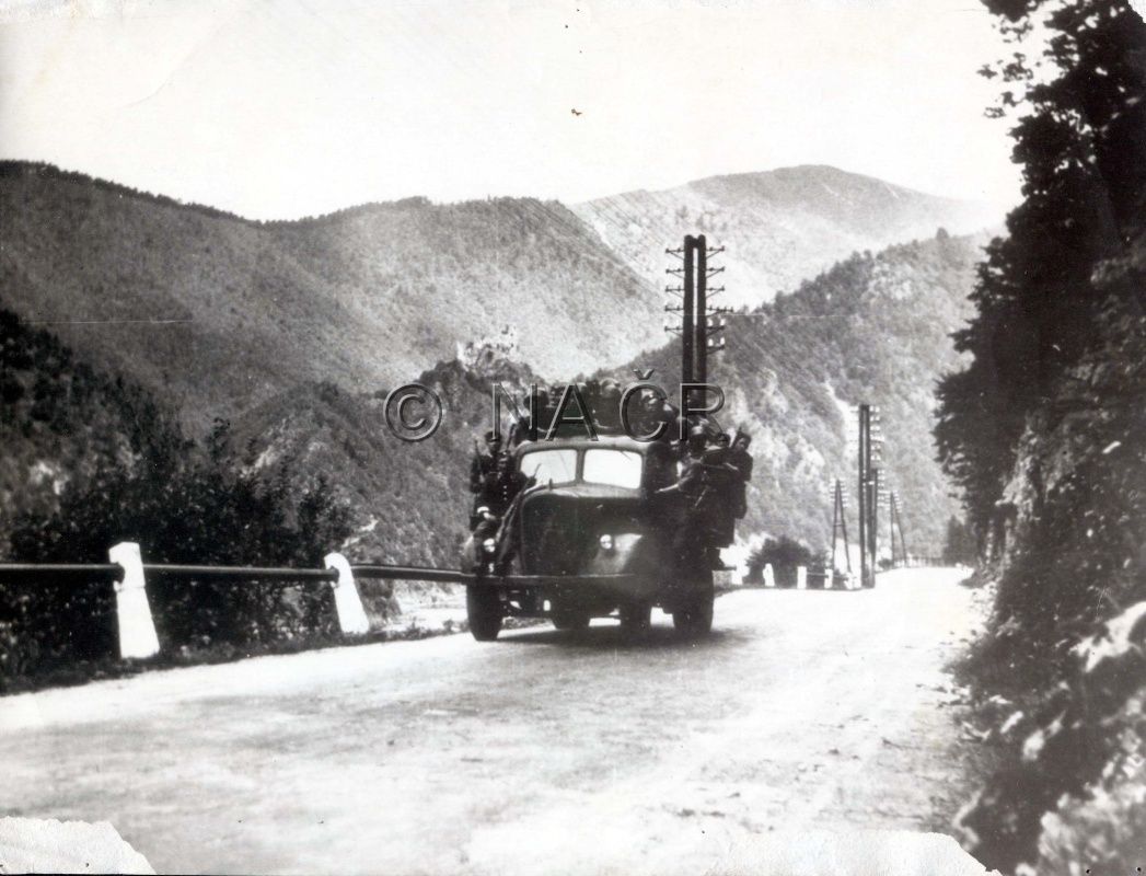
Deployment of the insurgent soldiers of the 1st Czechoslovak Army in Slovakia in the Malá Fatra Mountains on 31 August 1944. The National Archives, Prague
References
Pecka, J.: Na demarkační čáře. Americká armáda v Čechách 1945. Praha 1995;
Čejka, E.: Československý odboj na Západě (1939-1945). Praha 1997;
Zudová – Lešková, Z. a kol.: Československá armáda 1939 – 1945 (Plány a skutečnost). Praha 2002;
Cséfalvay, F. a kol.: Vojenské dějiny Slovenska, zv. 5. Bratislava 2008;
Hrbek, J. – Smetana, V. a kol.: Draze zaplacená svoboda: Osvobození Československa 1944–1945. Praha 2009;
Semotanová, E. ‒ Cajthaml, J. a kol.: Akademický atlas českých dějin. Praha 2014, 2. akt. vydání 2016.
This work is licensed under a Creative Commons BY-NC-ND 4.0
Liberation of Czechoslovakia in 1945
The developments on the war fronts in the mid-1944 and arrangements of the anti-Hitler coalition powers resulted in the decision to liberate Czechoslovakia from the east by the Red Army together with Czechoslovak, Romanian and Polish troops. From September 1944 until the end of 1944, the key military operations took place, starting with the Carpatho–Dukla, Uzhhorod and Ondava offensive that liberated the southern regions of Slovakia, then the Western Carpathian, Central Slovak, Ostrava and Bratislava–Brno offensive and the Prague offensive that culminated in the liberation of Czechoslovakia on 11 May 1945. Troops of the 3rd American Army advanced from the west to the agreed demarcation line and liberated part of the west and south Bohemia.
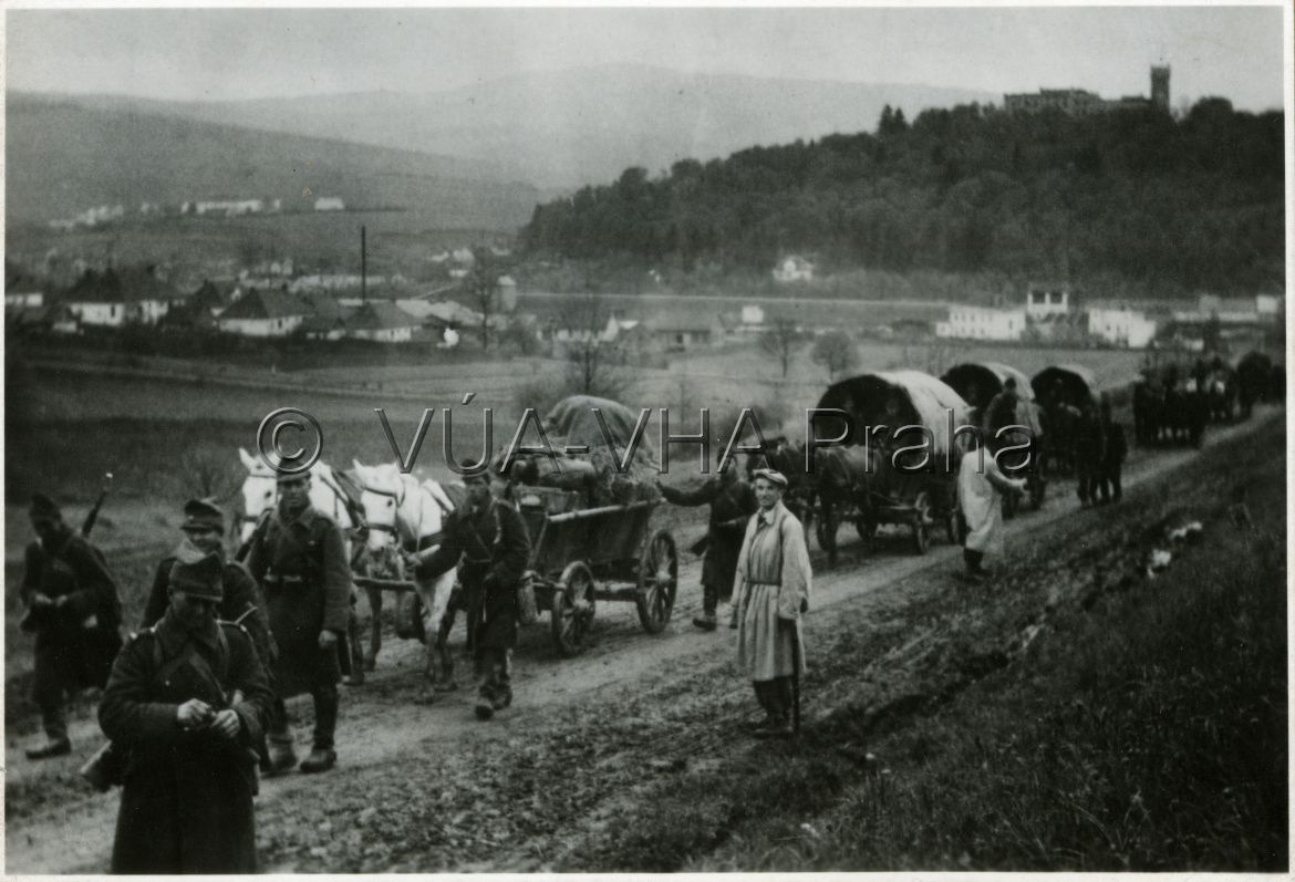
On 6 October 1944, troops of the 38th Red Army Division crossed the state border of the republic together with first units of the 1st Czechoslovak Army Corps in the USSR. However, at the end of October, the German troops managed to suppress the rebel army in central Slovakia and consequently the Battle of the Dukla Pass was terminated. Military Historical Archive Prague
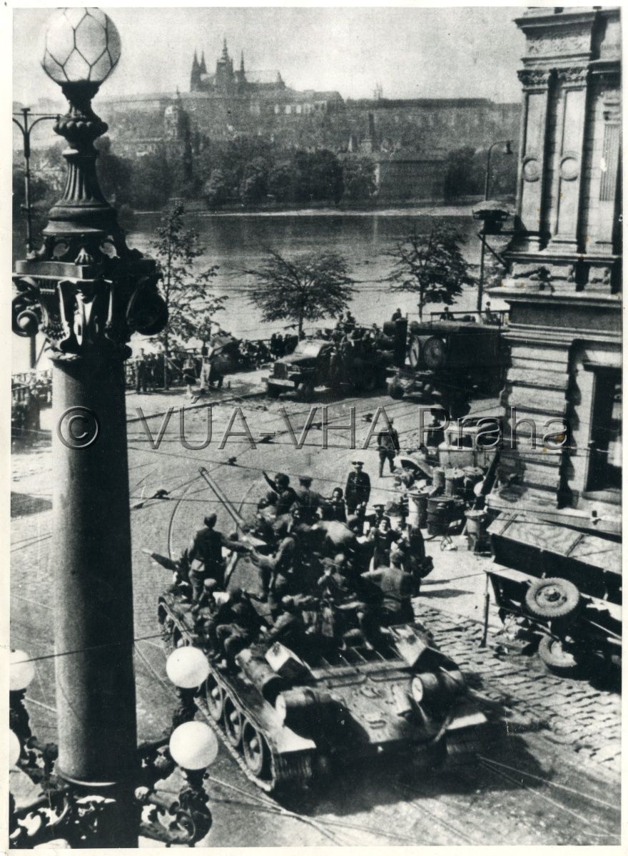
Red Army tanks in liberated Prague on 9 May 1945. Military Historical Archive Prague
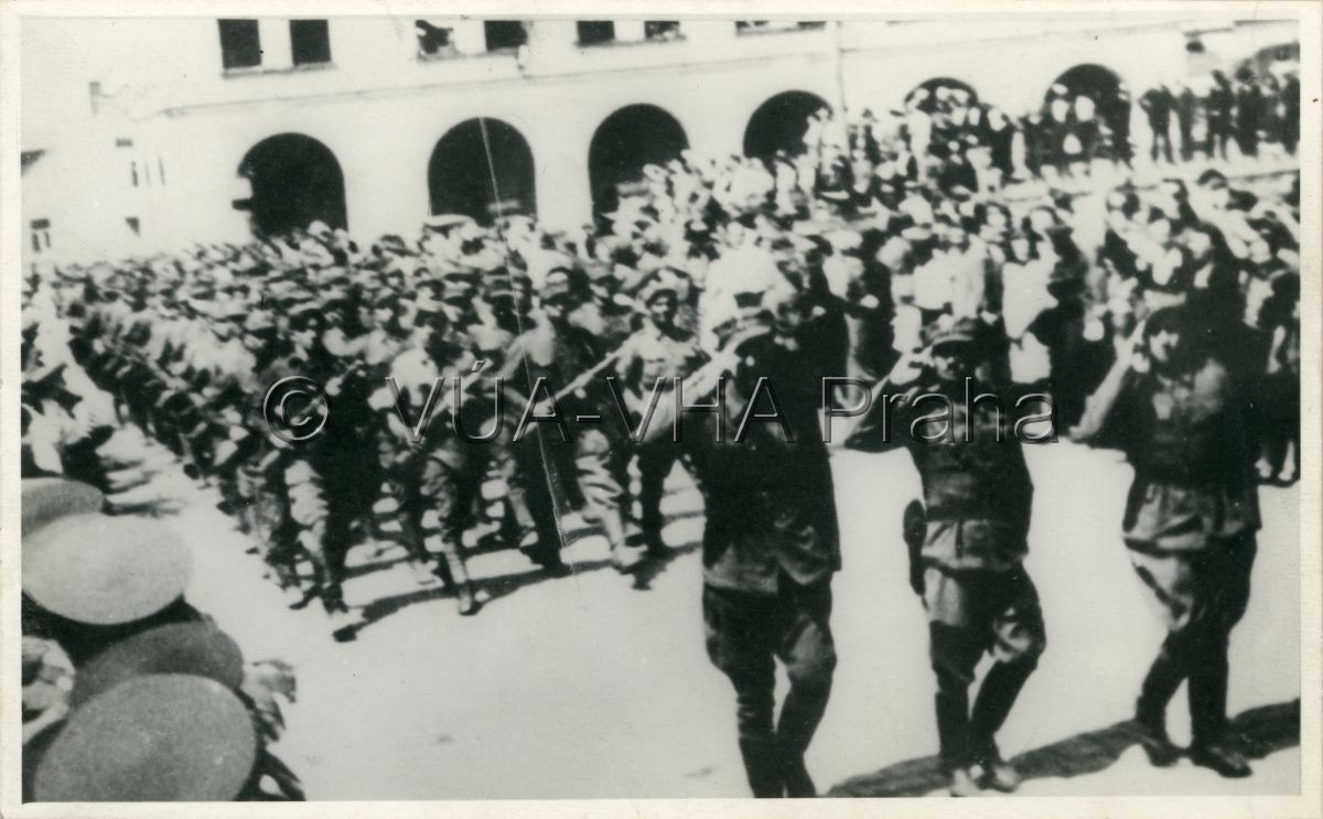
Members of the 1st and 4th Rumanian armies were significantly involved in the liberation of Slovakia and Moravia. Military Historical Archive Prague
Soldiers of the 2nd Polish army, liberators of Mělník in May 1945. Military Historical Archive Prague
References
Pecka, J.: Na demarkační čáře. Americká armáda v Čechách 1945. Praha 1995;
Čejka, E.: Československý odboj na Západě (1939-1945). Praha 1997;
Zudová – Lešková, Z. a kol.: Československá armáda 1939 – 1945 (Plány a skutečnost). Praha 2002;
Cséfalvay, F. a kol.: Vojenské dějiny Slovenska, zv. 5. Bratislava 2008;
Hrbek, J. – Smetana, V. a kol.: Draze zaplacená svoboda: Osvobození Československa 1944–1945. Praha 2009;
Semotanová, E. ‒ Cajthaml, J. a kol.: Akademický atlas českých dějin. Praha 2014, 2. akt. vydání 2016.
This work is licensed under a Creative Commons BY-NC-ND 4.0
Advance of the American units in western Bohemia
According to the agreed American-Soviet demarcation line, the Fifth and Twelfth Group of the United States Third Army commanded by General G. S. Patton advanced while liberating Czechoslovakia: on 18 April 1945, the first US troops entered Hranice v Čechách in the Aš Land and after several days of heavy fighting, they liberated Aš on 20 April and Cheb six days later. Then they advanced south-east, fighting in Czechoslovak border forests. The heaviest battle was fought for the Všeruby Pass and on 5 May, a territory on the Planá u Mariánských lázní – Klatovy line was liberated. One day later, the troops entered Pilsen. At the same time, fights continued on 6 and 7 May 1945 and the troops reached the agreed demarcation line along the Horní Dvořiště, Velešín and České Budějovice railway line.
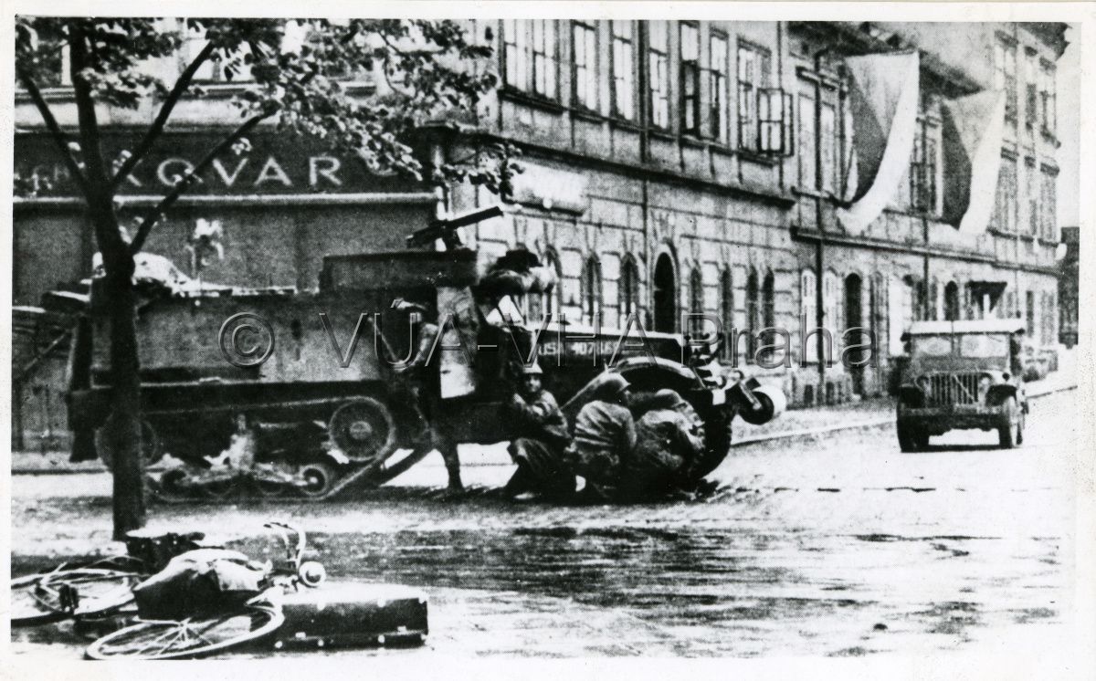
The American Army in the liberation of Plzeň on 5 May 1945. Military Historical Archive Prague
References
Pecka, J.: Na demarkační čáře. Americká armáda v Čechách 1945. Praha 1995;
Čejka, E.: Československý odboj na Západě (1939-1945). Praha 1997;
Zudová – Lešková, Z. a kol.: Československá armáda 1939 – 1945 (Plány a skutečnost). Praha 2002;
Cséfalvay, F. a kol.: Vojenské dějiny Slovenska, zv. 5. Bratislava 2008;
Hrbek, J. – Smetana, V. a kol.: Draze zaplacená svoboda: Osvobození Československa 1944–1945. Praha 2009;
Semotanová, E. ‒ Cajthaml, J. a kol.: Akademický atlas českých dějin. Praha 2014, 2. akt. vydání 2016.
This work is licensed under a Creative Commons BY-NC-ND 4.0