
Borders and Regions
The territorial reach of the individual communities and regions controlled by them has always been delimited by borders, which represent a strong civilizational, historical and geographical variable. Regions of various systems and sizes develop and change within the space and time together with their borders. Their delimitation is affected by the geographical conditions, but above all by the interests of groups with mutual power motivations, strategic, national, economic, cultural and other frequently very specific desires. The issue of the territorial and territorially administrative development is thus extremely complex.
The greatest milestones in the territorial and territorially administrative development of the Czech Lands are turning periods of the Czech and Czechoslovak statehood and the ensuing transformations of the territorial reach and the borders. These periods include the emergence of the Czech state in the 9th and 10th centuries, the Czech state under the last of the Přemyslid dynasty and under Charles IV, incorporation of the Czech Lands into the Habsburg Monarchy in 1526 and collapse of this monarchy (already as Austria-Hungary) in 1918. The temporary demise of our statehood in 1938-1945, the second arrival of totalitarianism in 1948, the strive for a reform in 1968 and above all the return of democracy after 1989 are connected with transformations of the territorial and social circumstances brought about by changes in the territorially administrative arrangements. In total, nine fundamental reforms of territorial administration occurred just at the time of modern administration following 1848. The changing regions and borders became part of the regional identity, often also as regions of historical memory that are reproduced as a part of our cultural heritage.
Tomáš Burda
Subchapters:
- Medieval Times 11th - 13th c.
- Regional System until 1850
- Regional System since 1850
- Administration 1918-1938
- Administration of Protectorate
- Administration since 1945
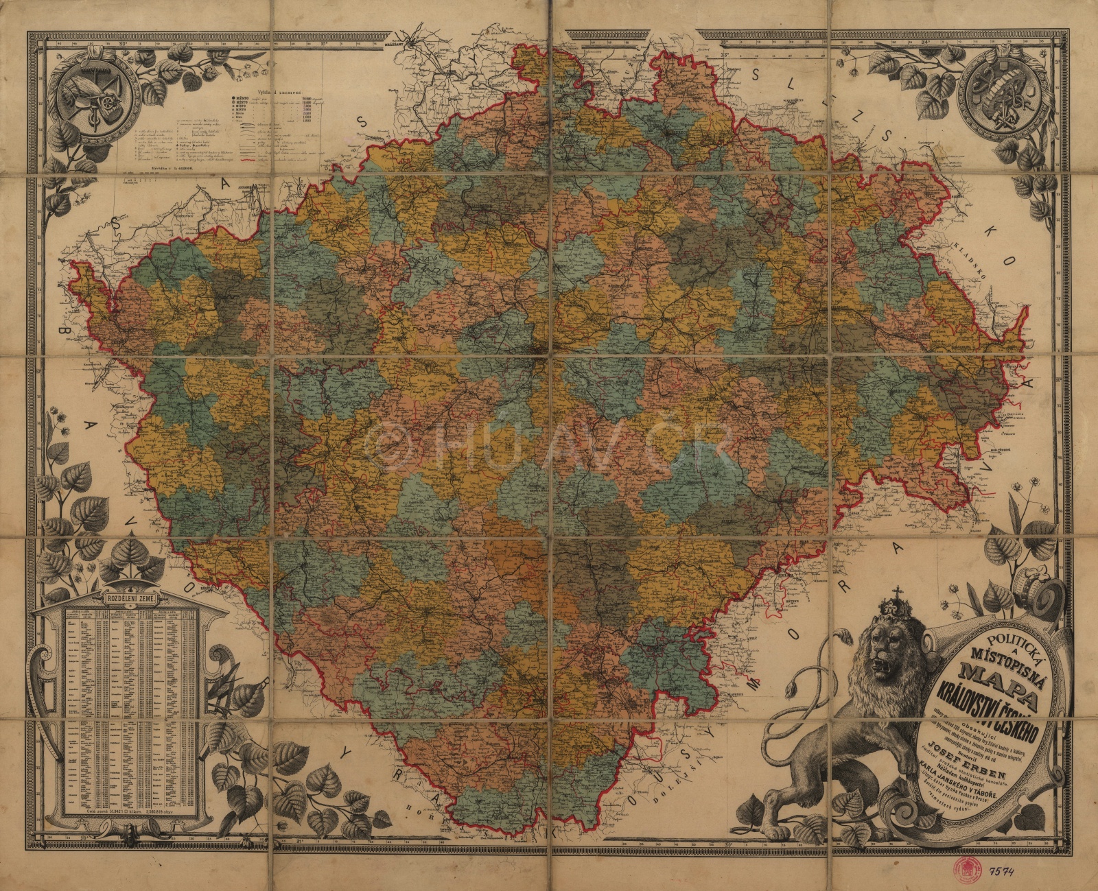
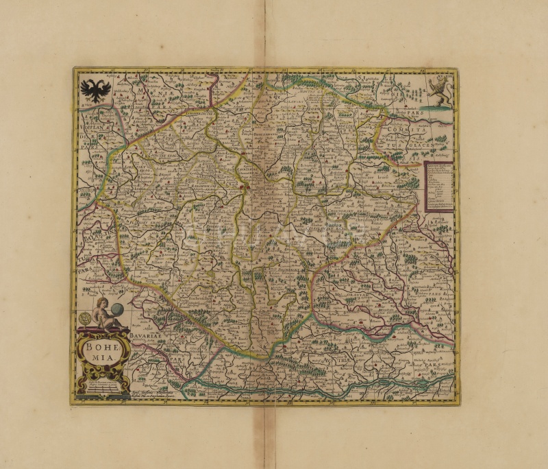
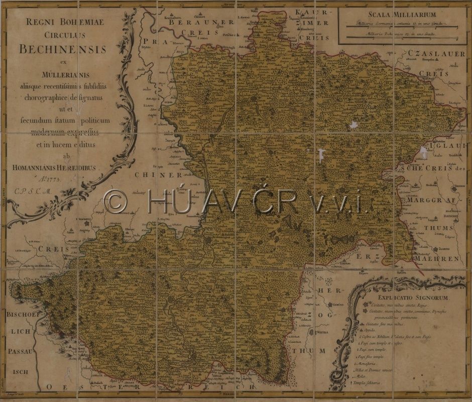
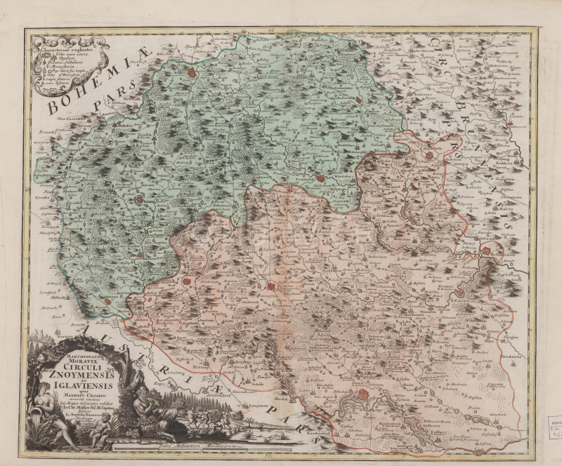
Political and toponymic map of the Kingdom of Bohemia by Josef Erben from the 2nd half of the 19th century. Map Collection of the Institute of History, CAS. Map display
Authors
historians: Tomáš Burda, Zdeněk Měřínský, Jan Němeček, Eva Semotanová, Aleš Vyskočil, Josef Žemlička
cartographers: Tomáš Janata, Jiří Cajthaml, Petra Jílková, Pavel Seemann
digital atlas: Tomáš Janata, Petra Jílková, Jiří Krejčí, Jitka Močičková, Eva Semotanová
team of authors
References
Hledíková, Z. – Janák, J. – Dobeš J.: Dějiny správy v českých zemích: od počátků státu po současnost. Praha 2005, dotisk 2011;
Semotanová, E. – Cajthaml, J. a kol.: Akademický atlas českých dějin. Praha 2014, 2. akt. vydání 2016;
Burda, T.: Historické hranice a proces polarizace prostoru v Česku. Praha 2016.
Related chapters:
BORDERS ans TERITORRIES
- Medieval Times until 12th c.
- Medieval Times 13th - 15th c.
- Early Modern Period
- Modern Period until 1918
- Modern Period since 1918