Origin of the regional system in Bohemia from the mid-15th century to 1714
From the early 14th, but mainly the late 14th and early 15th centuries, the regions were gradually formed in Bohemia as independent power, administrative and economic units. The territorial delimitation of these regions was facilitated by the appointment of regional executioners from the period of Charles IV who were in charge of law enforcement in the entrusted territory. In the early 15th century, there were twelve Bohemian regions whose names were derived from the tax regions. Under the rule of George of Poděbrady, the number of regions increased to fourteen and this number remained until the 1714 administrative reform.
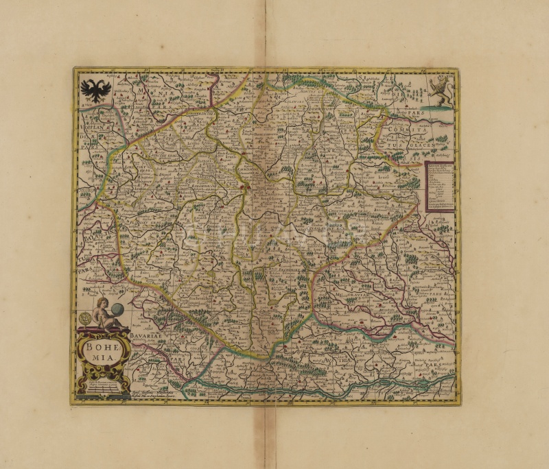
Map of Bohemia from Janssonius' atlas, created according to Aretin's map of Bohemia dated 1619. Map collection of the Institute of History, CAS Display map
References
Sedláček, A.: O starém rozdělení Čech na kraje. Praha 1921;
Janák, J. – Hledíková, Z. – Dobeš, J.: Dějiny správy v českých zemích: od počátku po současnost. Praha 2005;
Semotanová, E. ‒ Cajthaml, J. a kol.: Akademický atlas českých dějin. Praha 2014, 2. akt. vydání 2016.

This work is licensed under a Creative Commons BY-NC-ND 4.0
Regional system in the Czech Lands in 1724–1751
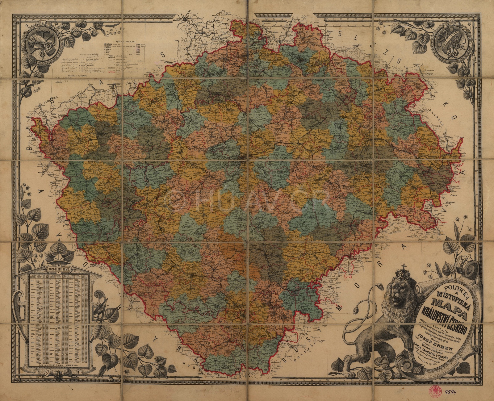
In 1714, the administrative reform reduced the number of regions in Bohemia from 14 to 12. The Cheb and Loket regions merged with the Žatec region. In Moravia in 1735, the Přerov-Bruntal district of the Olomouc region developed into the sixth Moravian region, i.e. the Přerov region. The independent territorial administrative development of Silesia and in particular the Moravian borderland ended in 1742 when only its section remained part of the Habsburg Monarchy, referred to as Bohemian or Austrian Silesia. It was divided into the principalities of Krnov, Nysa and Těšín. In the following administrative reform in 1751, the four largest regions were divided – Žatec into Žatec and Loket, Plzeň into Plzeň and Klatovy, Bechyně to Tábor and Budějovice and Hradec to Hradec and Bydžov. The sixteen Bohemian regions then survived without significant modifications until 1848. From the 1735 reform until 1848, Moravia was divided into six regions. In Silesia, the regions had not been established until 1783 when the Opava and Těšín regions were established in Bohemian, or Austrian Silesia.
References
Semotanová, E.: Mapy Čech, Moravy a Slezska v zrcadle staletí. Praha 2001, 2006;
Hledíková, Z. – Dobeš, J.: Dějiny správy v českých zemích od počátku státu po současnost. Praha 2005;
Semotanová, E. ‒ Cajthaml, J. a kol.: Akademický atlas českých dějin. Praha 2014, 2. akt. vydání 2016.
This work is licensed under a Creative Commons BY-NC-ND 4.0
Regional system in the Czech Lands in 1751–1850
In 1751, the administrative structure was reformed and the regional administration level was nationalized. In Bohemia, the number of regions increased to sixteen, in Moravia six regions remained. In Silesia, the regions (Opava and Těšín) were established in 1783 in connection with administrative merge of the land with Moravia when the so-called Moravian enclaves were incorporated into the Opava region. In this form (with certain border adjustments between the regions), this structure remained until the mid-19th century. The nationalisation of the regional administration was an important step, which increased the state's influence on the aristocratic and municipal authorities that had their own tax, judicial and political (police) powers.
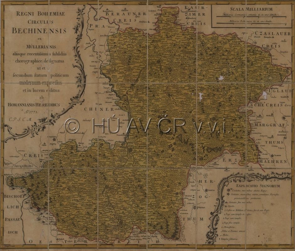
Map of the Bechyně region issued by Homman's heirs in 1773, derived from Müller's map of Bohemia dated 1720. However, at the time of the issue, the original Bechyně region had already been divided into 2 regions under the 1751 reform: the Tábor and Budějovice regions. Map Collection of the Institute of History, CAS.
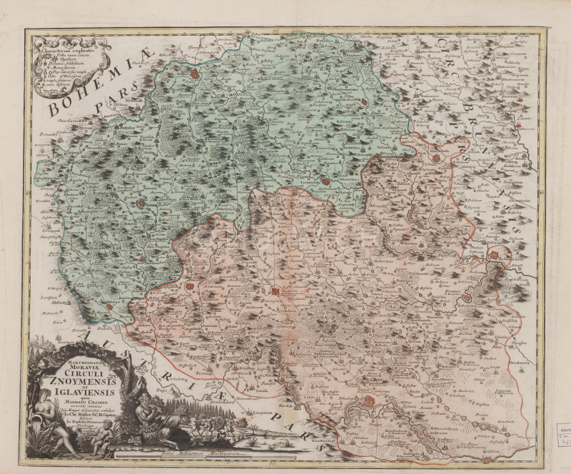
Homann's map of the Znojmo and Jihlava regions, ca 1720s – 30s, derived from Müller's map of Moravia dated 1716. Map Collection of the Institute of History, CAS. Display map
References
Semotanová, E.: Mapy Čech, Moravy a Slezska v zrcadle staletí. Praha 2001, 2006;
Hledíková, Z. – Dobeš, J.: Dějiny správy v českých zemích od počátku státu po současnost. Praha 2005;
Semotanová, E. ‒ Cajthaml, J. a kol.: Akademický atlas českých dějin. Praha 2014, 2. akt. vydání 2016.
This work is licensed under a Creative Commons BY-NC-ND 4.0