Establishment of the Habsburg Monarchy in the 16th century
From the early 16th century until the early 20th century, the history of the Czech lands is connected with the existence of the Habsburg Monarchy. This large Danubian monarchy came into existence in 1526 when, following the sudden death of Louis II of Hungary in the Battle of Mohács in the same year, Ferdinand I started to strive for the Bohemian and Hungarian thrones on the basis of the First Congress of Vienna (1515). He was elected the king in both cases. Ever since its creation, the Habsburg Monarchy thus represented a large territory populated by many nations with great economic and cultural differences.
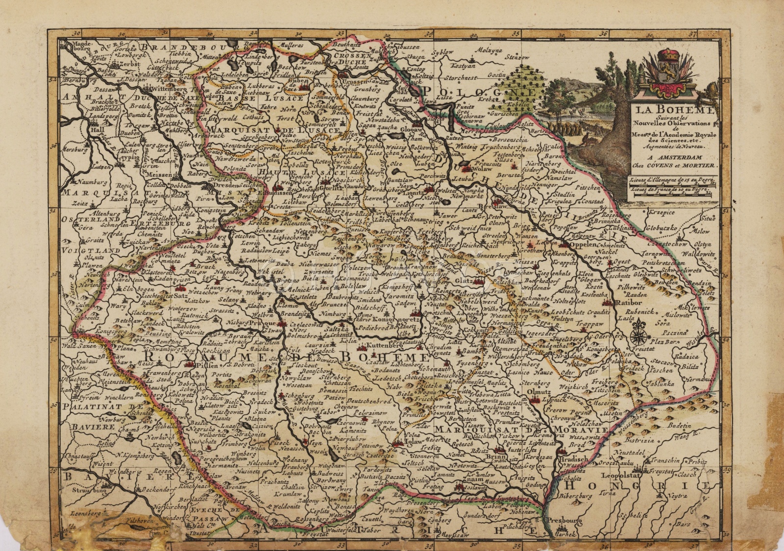
Map of Central Europe ("Romweg" map), Erhard Etzlaub, 1500, "South-up" display. Wikimedia Commons. Available here, [09/03/2021]. Display map
References
Janáček, J.: České dějiny. Doba předbělohorská 1526‒1547 I/1‒2. Praha 1968‒1984;
Bůžek, V. a kol.: Společnost českých zemí v raném novověku, Praha 2010;
Semotanová, E. ‒ Cajthaml, J. a kol.: Akademický atlas českých dějin. Praha 2014, 2. akt. vydání 2016

This work is licensed under a Creative Commons BY-NC-ND 4.0
The Czech Lands in the Habsburg Monarchy in the 17th and 18th centuries
In the 17th and 18th centuries, the internal development of the Habsburg Monarchy was aimed at centralisation of the state administration and enlightened absolutism. In the 18th century, the composite state of the Lands of the Bohemian Crown and Hungary became the so-called real union. However, the Lands of the Bohemian Crown lost significant territories. In 1635, Upper Lusatia and Lower Lusatia were ceded to Saxony and in 1742, following the defeat in the Silesian wars, the entire Lower Silesia and part of Upper Silesia were ceded to Prussia (definitively from 1763).The remaining part of Silesia (Cieszyn Silesia, part of the Opava, Krnov and Nysa regions) were later referred to as Bohemian or Austrian Silesia.
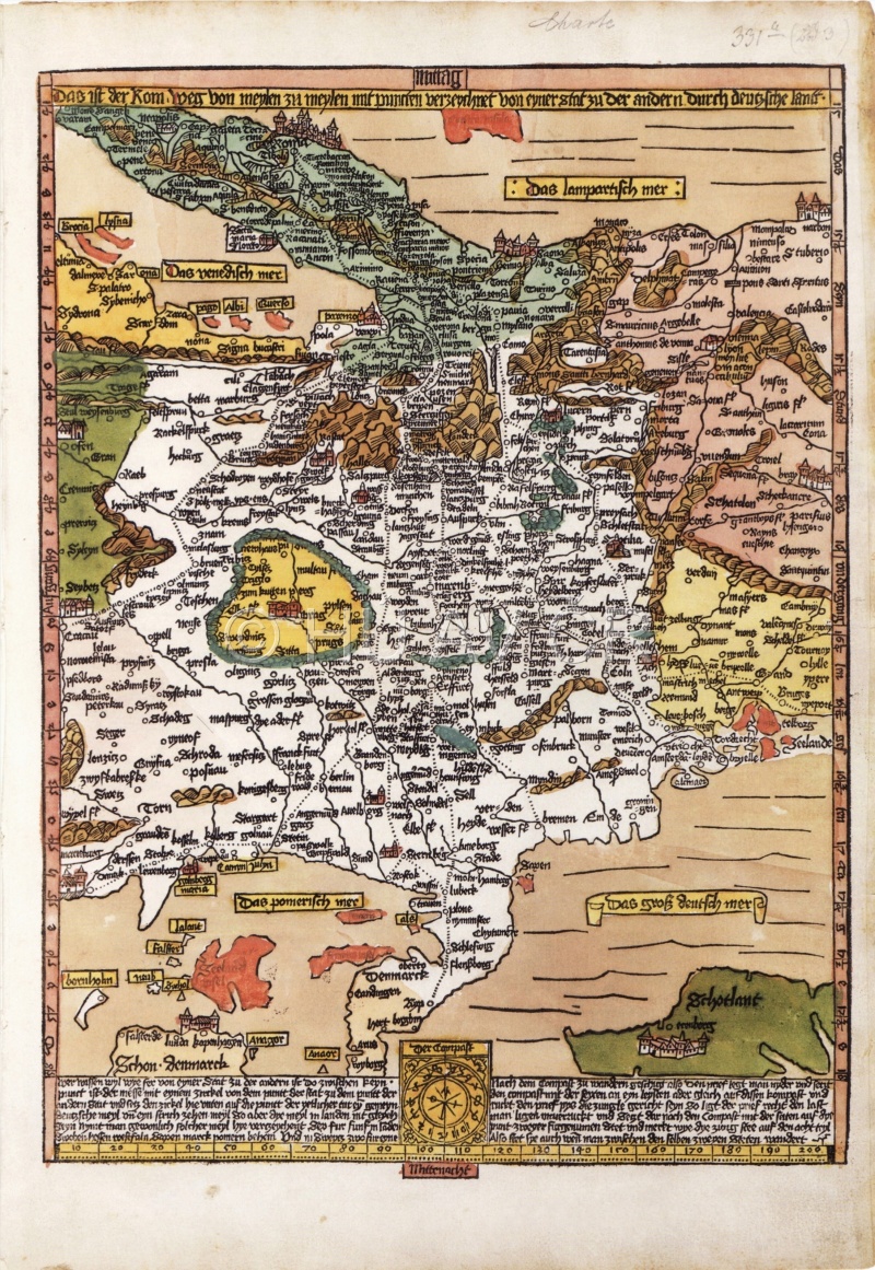
Map of the Czech Lands from 1695. Map Collection of the Institute of History, CAS. Display map
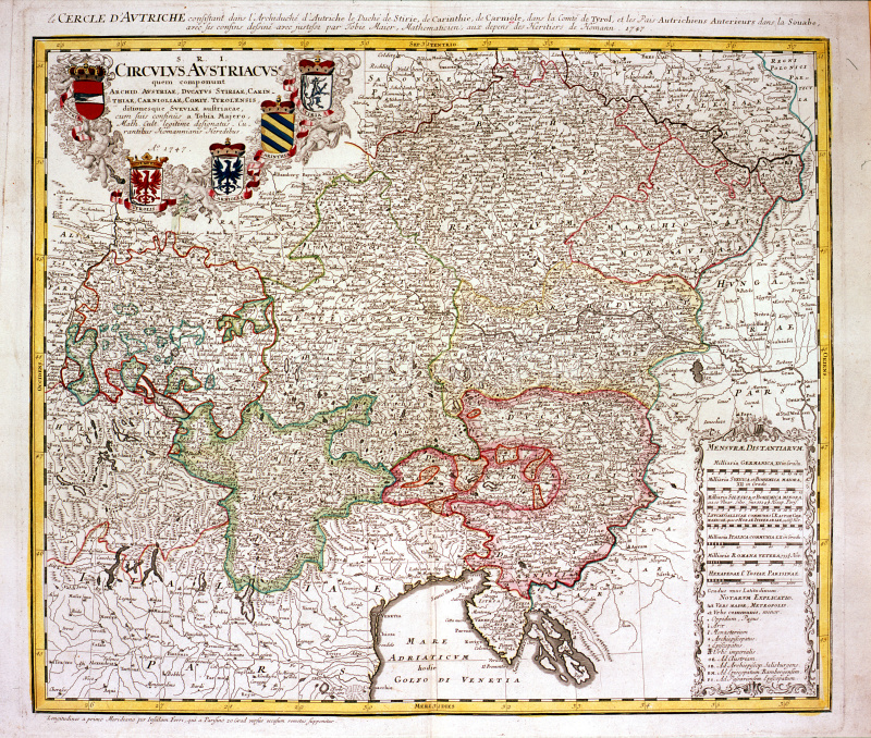
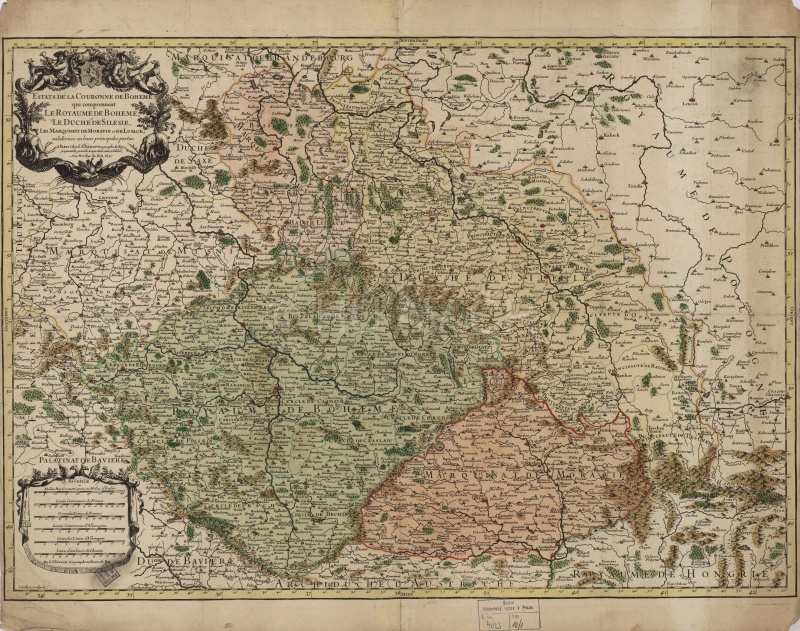
Map of the Habsburg Monarchy from 1747. Map Collection of the Institute of History, CAS.
References
Hrbek, J.: Evropa a absolutismus v 17. a 18. století (1648 ‒ 1789) . Praha 2012;
Semotanová, E. ‒ Cajthaml, J. a kol.: Akademický atlas českých dějin. Praha 2014, 2. akt. vydání 2016;
Mikulec, J.: České země v letech 1620–1705: od velké války k dlouhému míru. Praha 2016.
This work is licensed under a Creative Commons BY-NC-ND 4.0