Administrative structure of the Czech Lands after 1850
The administration was quickly modernised in 1848-1850 by abolition of patrimonial administration and establishment of judicial and political districts as the basic units of the state administration. There were 7 regions with 79 political districts in Bohemia, 2 regions with 25 political districts in Moravia and only 7 districts in Silesia. The following reforms mainly concerned higher-level units. In 1855, the political districts were cancelled and the number of regions increased (Bohemia had 13 regions and 208 mixed districts, Moravia 6 regions and 76 districts and Silesia 2 regions and 22 districts. After 1862 (or 1868), the regional administration was cancelled as an unnecessary link between the districts and the lands. The number of districts gradually grew, mainly in the fast-growing industrial areas.
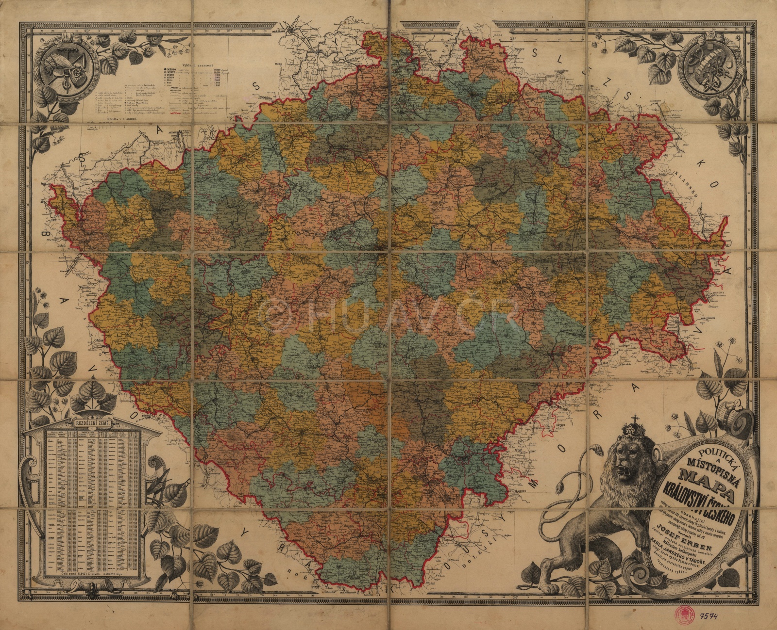
Political and toponymic map of the Kingdom of Bohemia by Josef Erben from the 2nd half of the 19th century. Map Collection of the Institute of History, CAS. Display map
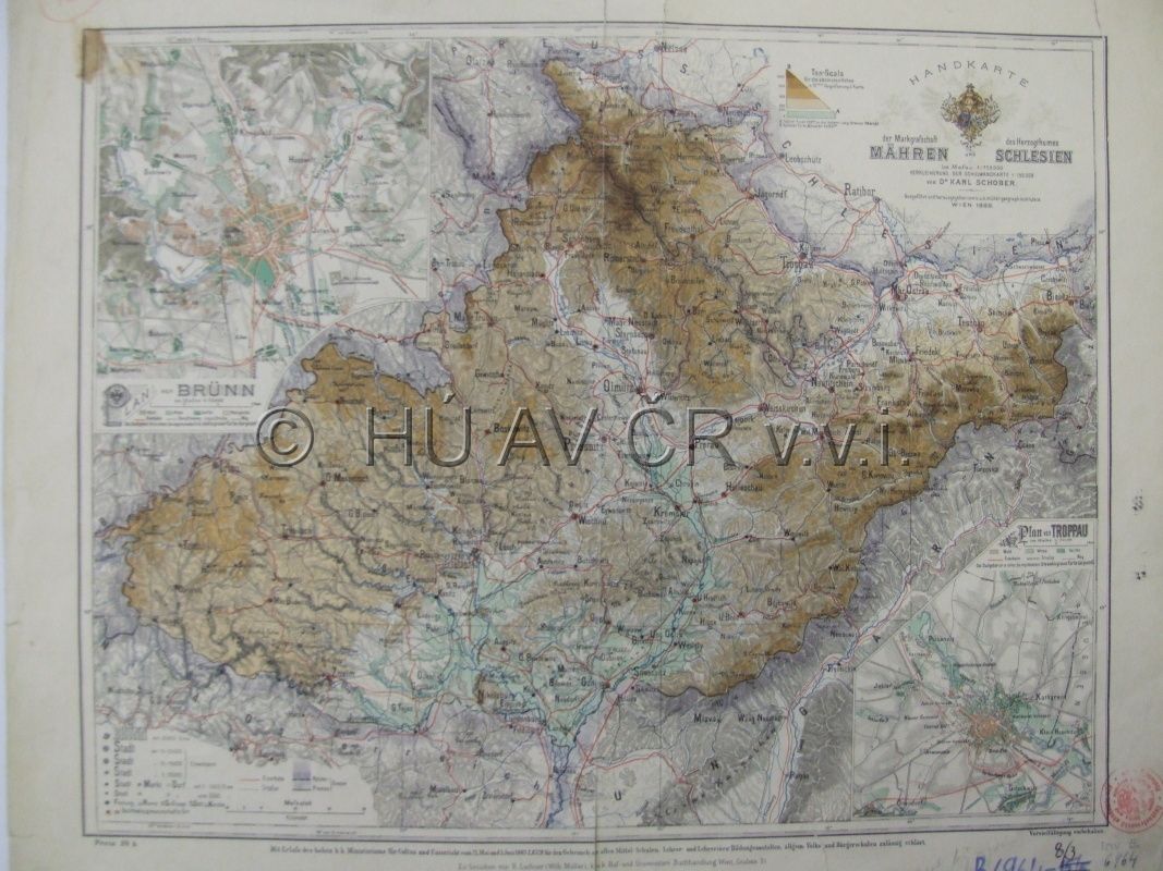
Map of Moravia and Silesia by Karel Schober (1888). Map Collection of the Institute of History, CAS.
References
Semotanová, E.: Historická geografie českých zemí. Praha 2002, 2006;
Dobeš, J.: Dějiny správy v českých zemích: od počátku po současnost. Praha 2005;
Semotanová, E. ‒ Cajthaml, J. a kol.: Akademický atlas českých dějin. Praha 2014, 2. akt. vydání 2016.

This work is licensed under a Creative Commons BY-NC-ND 4.0
Political districts of Bohemia
The administration was quickly modernised in 1848-1850 by abolition of patrimonial administration and establishment of judicial and political districts as the basic units of the state administration. There were 7 regions with 79 political districts in Bohemia, 2 regions with 25 political districts in Moravia and only 7 districts in Silesia. The following reforms mainly concerned higher-level units. In 1855, the political districts were cancelled and the number of regions increased (Bohemia had 13 regions and 208 mixed districts, Moravia 6 regions and 76 districts and Silesia 2 regions and 22 districts. After 1862 (or 1868), the regional administration was cancelled as an unnecessary link between the districts and the lands. The number of districts gradually grew, mainly in the fast-growing industrial areas.
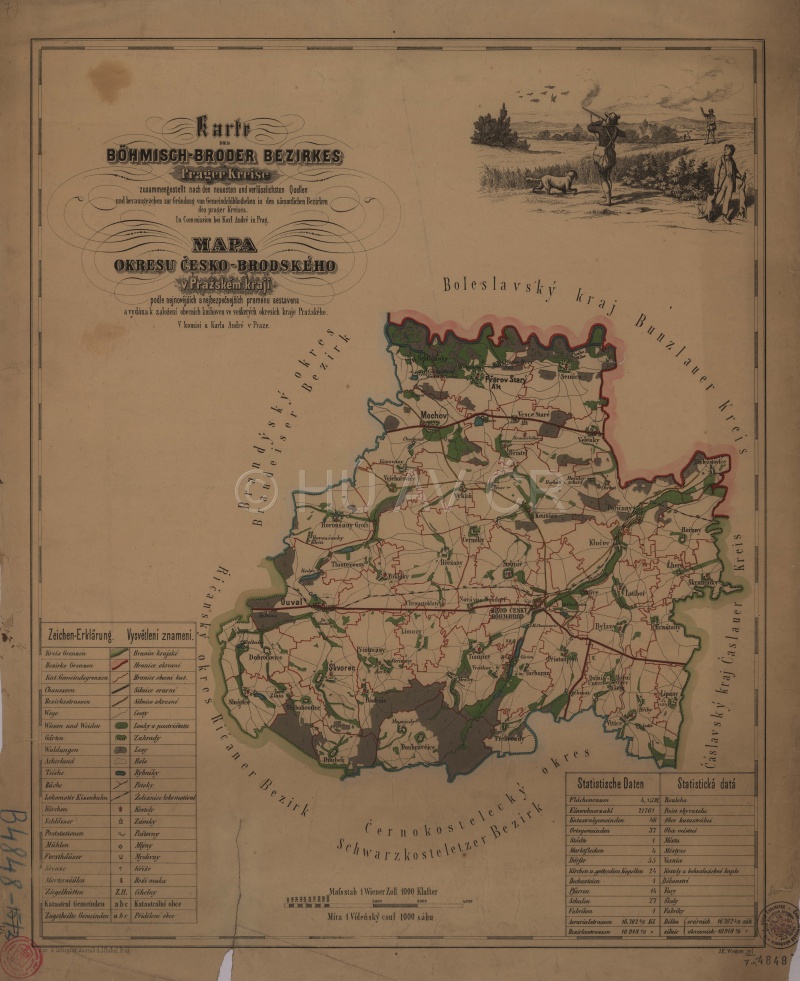
Map of Český Brod District (ca 1861). Map Collection of the Institute of History, CAS. Display map
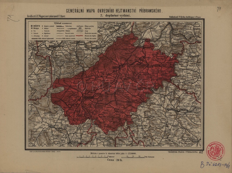
General map of Příbram District (1905). Map Collection of the Institute of History, CAS. Display map
References
Semotanová, E.: Historická geografie českých zemí. Praha 2002, 2006;
Dobeš, J.: Dějiny správy v českých zemích: od počátku po současnost. Praha 2005;
Semotanová, E. ‒ Cajthaml, J. a kol.: Akademický atlas českých dějin. Praha 2014, 2. akt. vydání 2016.
This work is licensed under a Creative Commons BY-NC-ND 4.0