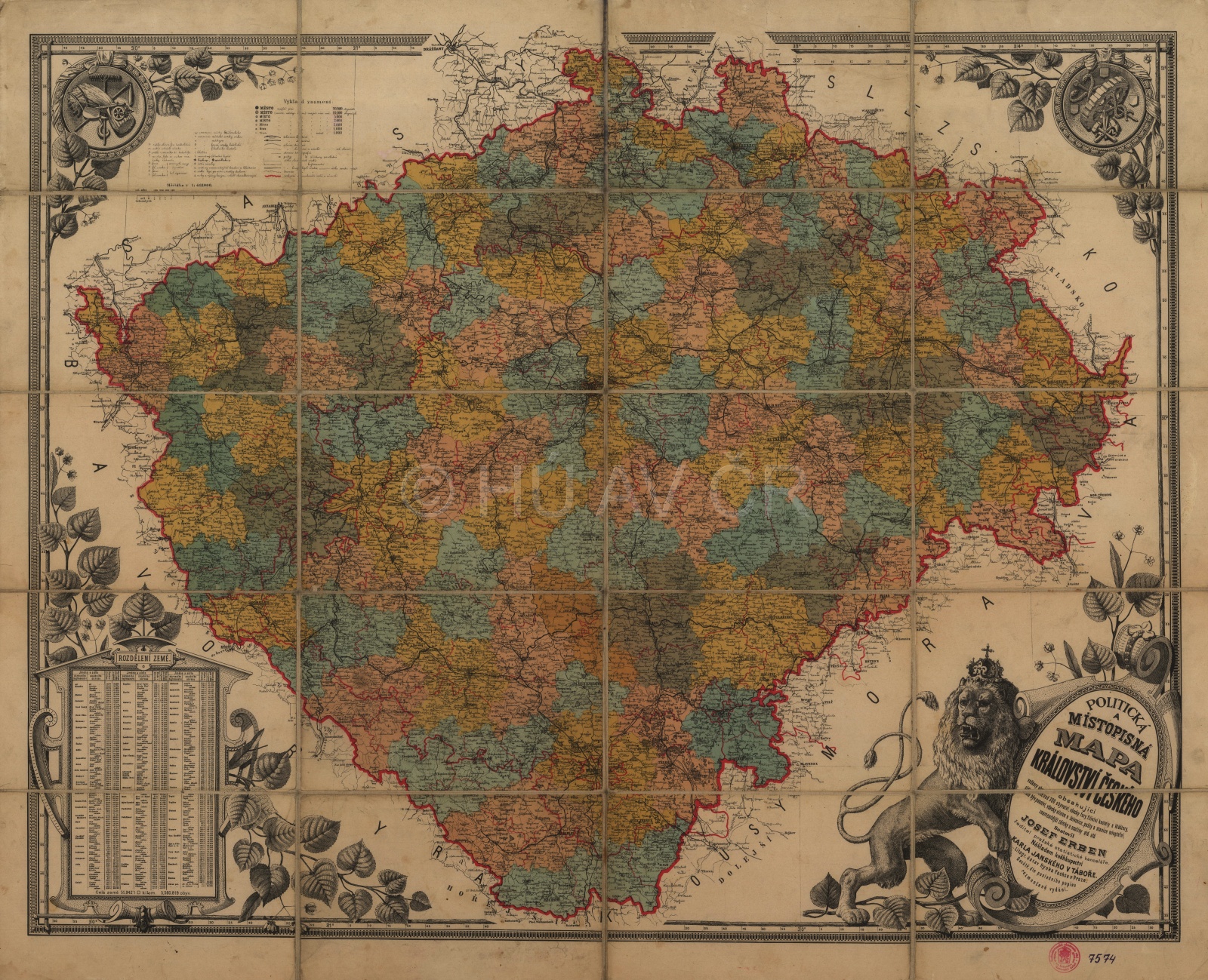
Draft of a county system up to 1920
After the establishment of Czechoslovakia, the existing territorial administration system was adopted, but it suffered from great fragmentation. Therefore, preparation of a new county structure was prepared and adopted on 29 February 1920. 21 counties were established, of which 9 in Bohemia and Moravia and 6 in Silesia. Prague was excluded from the county system. Some of the counties were to be almost entirely populated by the Germans (Česká Lípa, Karlovy Vary, Louny) and the district governments as well as the political districts were to be abolished. The county law was put into practice only in Slovakia. The county structure was soon opposed and abandoned in 1927.
Map of Czechoslovak county structure according to the law of 1920. Map Collection of the Institute of History, CAS. Display map
References
Hledíková, Z. – Janák, J. – Dobeš, J.: Dějiny správy v českých zemích: od počátků státu po současnost. Praha 2005;
Mleziva, Š.: Retrospektivní přehled územních jednotek a územních celků od roku 1850 do současnosti. Praha 2010;
Semotanová, E. – Cajthaml, J. a kol.: Akademický atlas českých dějin. Praha 2014, 2. akt. vydání 2016;
Burda, T.: Historické hranice a proces polarizace prostoru v Česku. Praha 2016;
Burda, T.: Vnitřní hranice Československa 1918-1938. Cesta k emancipaci nového státu, in: Hranice v krajinách (Semotanová, E. ed.). Praha 2020;
Semotanová, E. Zudová-Lešková, Z. ‒ Močičková, J. Cajthaml, J. ‒ Seemann, P. ‒ Bláha J. D. a kol.: Český historický atlas. Kapitoly z dějin 20. století. Praha 2019.

This work is licensed under a Creative Commons BY-NC-ND 4.0
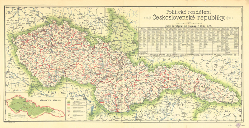
Land system until 1930
The administration unification arrived with adoption of the so-called Organization Law, which came into force in 1928 and returned the land administration system and political districts. Czechoslovakia was divided into four lands – Bohemia (Prague) and Moravia-Silesia (Brno) on the territory of today's Czech Republic. Moravia was thus unified with Silesia and the Moravian-Silesian border practically disappeared. The highest element of the territorial government was the land government with land representatives. In 1928, there were 103 political districts and 223 judicial districts in Bohemia and 45 political and 105 judicial districts in Moravia-Silesia.
This system lasted until October 1938 and was restored after 1945. With minor changes, it worked until 1949.
General Map of Czechoslovakia (1931). Map Collection, Institut of History CAS. Display map
References
Hledíková, Z. – Janák, J. – Dobeš, J.: Dějiny správy v českých zemích: od počátků státu po současnost. Praha 2005;
Mleziva, Š.: Retrospektivní přehled územních jednotek a územních celků od roku 1850 do současnosti. Praha 2010;
Semotanová, E. – Cajthaml, J. a kol.: Akademický atlas českých dějin. Praha 2014, 2. akt. vydání 2016;
Burda, T.: Historické hranice a proces polarizace prostoru v Česku. Praha 2016;
Burda, T.: Vnitřní hranice Československa 1918-1938. Cesta k emancipaci nového státu, in: Hranice v krajinách (Semotanová, E. ed.). Praha 2020;
Semotanová, E. Zudová-Lešková, Z. ‒ Močičková, J. Cajthaml, J. ‒ Seemann, P. ‒ Bláha J. D. a kol.: Český historický atlas. Kapitoly z dějin 20. století. Praha 2019.
This work is licensed under a Creative Commons BY-NC-ND 4.0
Judicial administration. Districts of regional courts in 1930
The regional courts were based in the regional capitals from 1855–1868. There was a court in the former Čáslav region in Kutná Hora and the former Žatec region in Most. Later, courts were established in Liberec and Česká Lípa and also in Klatovy in 1928. The court in Těšín was transferred to Moravská Ostrava after the division of the Těšín region. This system lasted until 1949. After the 1949 administration reform, the court districts merged with the administrative districts and new regional courts were established in all of the 13 new regional capitals. A further reduction was made in 1960 when only 8 regional courts operated on the territory of today's Czech Republic.
References
Malý, K.: Vývoj práva v Československu v letech 1945–1989. Praha 2004;
Hledíková, Z. – Janák, J. – Dobeš, J.: Dějiny správy v českých zemích: od počátků státu po současnost. Praha 2005;
Burda, T.: Historické hranice a proces polarizace prostoru v Česku. Praha 2016;
Semotanová, E. Zudová-Lešková, Z. ‒ Močičková, J. Cajthaml, J. ‒ Seemann, P. ‒ Bláha J. D. a kol.: Český historický atlas. Kapitoly z dějin 20. století. Praha 2019.
This work is licensed under a Creative Commons BY-NC-ND 4.0