Regional system in 1949–1960
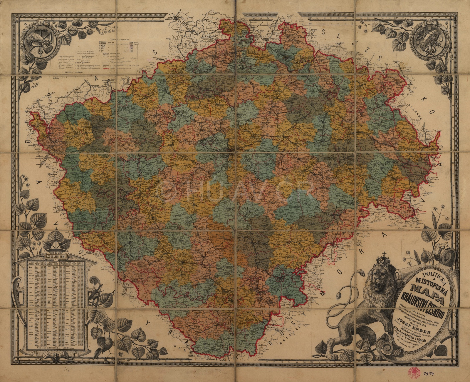
In 1949, after more than 80 years, the regional administrative level was re-established, the lands were cancelled (for the first time, not even the Bohemian-Moravian land border was respected) and the judicial and administrative districts were unified. In total, 13 regions and 176 districts were established on the territory of today's Czech Republic. According to the law on the establishment or regional and district local committees and delimitation of their perimeters, these districts were created by transformation of political districts (or extension of their number and division of the existing districts into the particular political districts) and the original judiciary districts were cancelled. This reform took place in a new political situation and unlike the county law, it did not have to deal with the ethnic issues.
In 1949, the traditional land administrative structure was cancelled and the regions returned after almost 100 years. Map Collection of the Institute of History, CAS. Display map
References
Hledíková, Z. – Janák, J. – Dobeš, J.: Dějiny správy v českých zemích: od počátků státu po současnost. Praha 2005;
Semotanová, E. – Cajthaml, J. a kol.: Akademický atlas českých dějin. Praha 2014, 2. akt. vydání 2016;
Burda, T.: Historické hranice a proces polarizace prostoru v Česku. Praha 2016;
Ouředníček, M. a kol.: Prostorová a statistická data ke stažení. Online, dostupné z: http://www.historickygis.cz/shp-vrstvy [ověřeno 13. 5. 2019];
Semotanová, E. Zudová-Lešková, Z. ‒ Močičková, J. Cajthaml, J. ‒ Seemann, P. ‒ Bláha J. D. a kol.: Český historický atlas. Kapitoly z dějin 20. století. Praha 2019.

This work is licensed under a Creative Commons BY-NC-ND 4.0
Regional system in 1960–1990
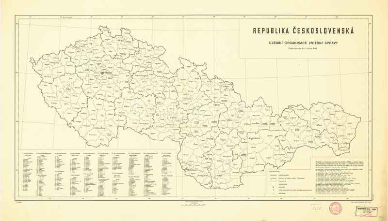
After 11 years, the new political and social situation demanded further centralization and modification of the administration based in particular on economic regionalization of the territory. The territory of today's Czech Republic was divided into 8 large regions (including Prague), which were divided into 75 districts and Prague was divided into 10 urban districts. The new administrative units were often formed by merging the old units, in particular the regions (the former Ústí and Liberec regions created the North Bohemian region, the Hradec and Pardubice regions together with Semily and Havlíčkův Brod created the East Bohemian region, etc.). The districts were completely new, with no regard to the existing regional structure or natural bonds and relations between the individual centres.
Administrative map of CSSR from 1965. Map Collection of the Institute of History, CAS. Display map
References
Hledíková, Z. – Janák, J. – Dobeš, J.: Dějiny správy v českých zemích: od počátků státu po současnost. Praha 2005;
Semotanová, E. – Cajthaml, J. a kol.: Akademický atlas českých dějin. Praha 2014, 2. akt. vydání 2016;
Burda, T.: Historické hranice a proces polarizace prostoru v Česku. Praha 2016;
Ouředníček, M. a kol.: Prostorová a statistická data ke stažení. Online, dostupné z: http://www.historickygis.cz/shp-vrstvy [ověřeno 13. 5. 2019];
Semotanová, E. Zudová-Lešková, Z. ‒ Močičková, J. Cajthaml, J. ‒ Seemann, P. ‒ Bláha J. D. a kol.: Český historický atlas. Kapitoly z dějin 20. století. Praha 2019.
This work is licensed under a Creative Commons BY-NC-ND 4.0
Territorial administration in 1990–1999
In November 1990, the local regional committees were cancelled, but not the regions. The local district committees turned into district authorities headed by a superintendent, but the district councils were not established. Only district assemblies were established to represent the municipalities in the district. The planned changes regarding the number of districts thus did not take place except the Jeseník district in 1996. Also the lowest level of municipalities experienced rapid development. The system of central villages was quickly cancelled and the number of individual municipalities grew from about 4,100 to 5,690. At the same time, municipalities whose bodies exercise delegated powers, the so-called II-type municipalities were quickly established in 1990 and their number was stabilized as 387.
References
Hledíková, Z. – Janák, J. – Dobeš, J.: Dějiny správy v českých zemích: od počátků státu po současnost. Praha 2005;
Semotanová, E. – Cajthaml, J. a kol.: Akademický atlas českých dějin. Praha 2014, 2. akt. vydání 2016;
Burda, T.: Historické hranice a proces polarizace prostoru v Česku. Praha 2016;
Ouředníček, M. a kol.: Prostorová a statistická data ke stažení. Online, dostupné z: http://www.historickygis.cz/shp-vrstvy [ověřeno 13. 5. 2019];
Semotanová, E. Zudová-Lešková, Z. ‒ Močičková, J. Cajthaml, J. ‒ Seemann, P. ‒ Bláha J. D. a kol.: Český historický atlas. Kapitoly z dějin 20. století. Praha 2019.
This work is licensed under a Creative Commons BY-NC-ND 4.0
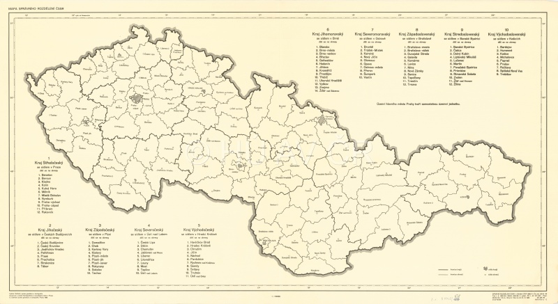
Regional system since 2000
The current administrative structure is the result of a two-phase territorial administration reform between 1997 and 2000 and between 2002 and 2003. In the first phase, 14 autonomous regions were established in the Czech Republic with the same capitals as in the years 1949–1960. However, the regions were defined on the basis of districts, which were created in 1960. This fact resulted in numerous disproportions and unsuitable definitions of the newly established units. In 2007, borders of some regions were corrected and territories between the individual regions were relocated (e.g. between the Vysočina Region and the South Moravian Region and between the Moravian-Silesian Region and the Olomouc Region). In the second phase, on 1 January 2003, the district authorities were cancelled and partly transferred to the regional authorities and to 205 municipalities whose bodies exercise delegated powers (ORP). The borders no longer respected the borders of the former district boundaries to some extent. Since 2005, the district borders have been modified in several stages and are still valid for some organs of the public administration (courts, police) so that they correspond to the existing ORP borders.
References
Hledíková, Z. – Janák, J. – Dobeš, J.: Dějiny správy v českých zemích: od počátků státu po současnost. Praha 2005;
Semotanová, E. – Cajthaml, J. a kol.: Akademický atlas českých dějin. Praha 2014, 2. akt. vydání 2016;
Burda, T.: Historické hranice a proces polarizace prostoru v Česku. Praha 2016;
Ouředníček, M. a kol.: Prostorová a statistická data ke stažení. Online, dostupné z: http://www.historickygis.cz/shp-vrstvy [ověřeno 13. 5. 2019];
Semotanová, E. Zudová-Lešková, Z. ‒ Močičková, J. Cajthaml, J. ‒ Seemann, P. ‒ Bláha J. D. a kol.: Český historický atlas. Kapitoly z dějin 20. století. Praha 2019.
This work is licensed under a Creative Commons BY-NC-ND 4.0