Ethnic structure of the Czech Lands until 1935
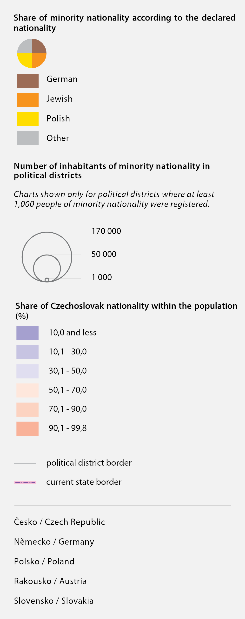
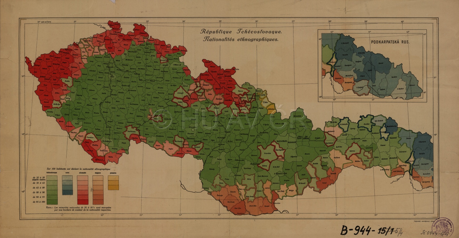
After 1918, the population of Czechoslovakia consisted of Czech, Slovak and German ethnic groups and other minorities. After the 1930 census, the population was 14,730,000. The Czechs and Slovaks represented about 65 % of the population, Germans about 23 %, Hungarians over 5%, Ruthenians, Ukrainians and Russians about 3.5 %, Jews about 1.3 % and Poles 0.6 %. In the second half of the 1930s, nationalistic tendencies started to grow in the German milieu as well as Slovakia. The map contains data from the 1930 census illustrated by the application of isolines and a cartogram based on a combination of the territorial and population principles.
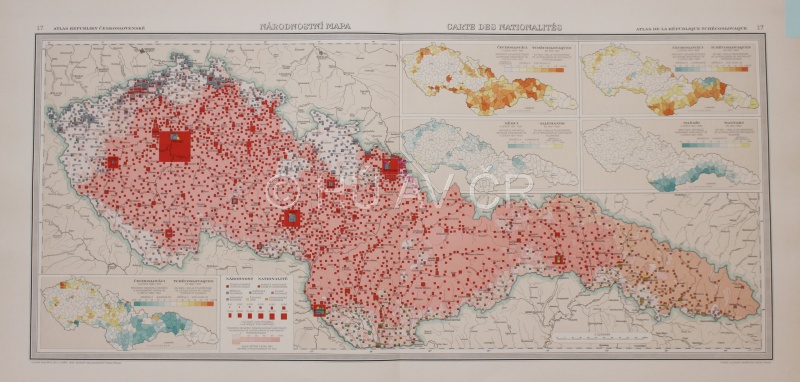
Ethnic map of Czechoslovakia from 1933, in: Atlas Republiky československé (1935). Map Collection of the Institute of History, CAS.
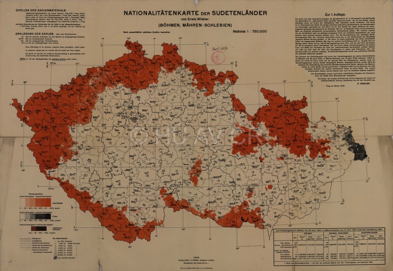
E. WINKLER, Nationalitätenkarte der Sudetenländer: Böhmen, Mähren-Schlesien (1936). Map Collection of the Institute of History, CAS.
References
Atlas republiky Československé. Praha 1935;
Semotanová, E. ‒ Cajthaml, J. a kol.: Akademický atlas českých dějin. Praha 2014, 2. akt. vydání 2016;
Holubec, S. – Močičková, J.: Zobrazování česko-německé národnostní hranice na mapách v období cca 1820–1940, Historická geografie 46/2, 2020, s. 263–320;
Národnostní diverzita na mapách českých zemí - kartografický obraz a realita: http://www.hiu.cas.cz/cs/mapova-sbirka/narodnostni-mapy-ceskych-zemi.ep/.

This work is licensed under a Creative Commons BY-NC-ND 4.0
Ethnic changes in the Czech Lands after the resettlement of the German population in 1946
The efforts to deal with ethnic minorities in post-war Czechoslovakia and the anti-German tendencies in the society culminated in the resettlement of the German population. Initially, it proceeded spontaneously (the so-called “violent resettlement” connected with violence against the Germans), but when it was internationally agreed at the Potsdam Conference, it was organized from January until November 1946. The resettled people were mostly Czechoslovak Germans from the border areas, but also from large towns with German minority. In 1947–1948, supplementary resettlement united the torn families. In total, about 3,000,000 Germans left Czechoslovakia, the estimated number of victims is 19,000–30,000. After 1948, only anti-fascists, people from mixed marriages and the so-called indispensable experts remained in Czechoslovakia, in total about 185,000 people.
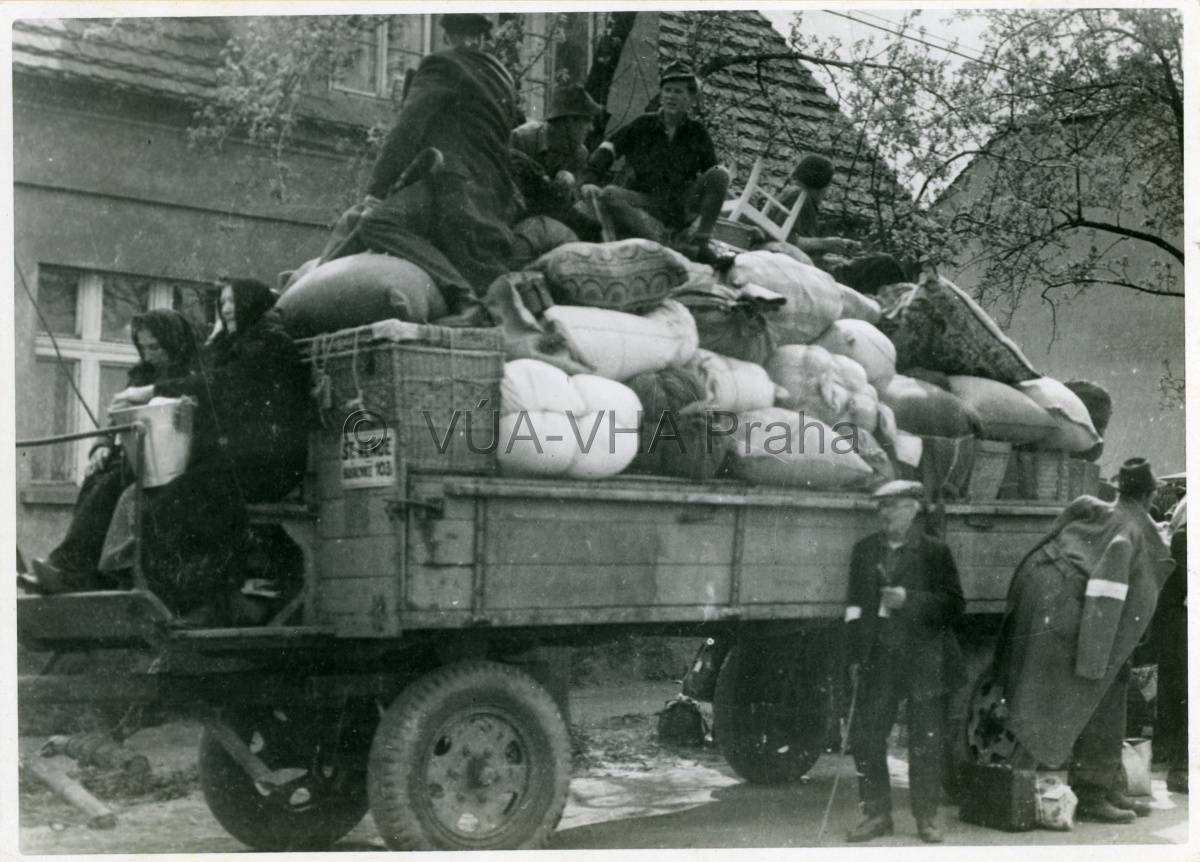
Resettlement of the German population from Vítkov u Falknova (now Sokolov). After the post-war resettlement, Vítkov was newly resettled. Most of the houses and businesses were acquired by the Czechs and Slovaks. The village disappeared due to the opening of the Michal coal mine. VÚA-VHA Praha
References
Staněk, T.: Internierung und Zwangsarbeit. Das Lagersystem in den böhmischen Ländern 1945–1948. München 2007;
Arburg, A. von – Staněk, T. (eds.): Vysídlení Němců a proměny českého pohraničí 1945–1951. Dokumenty z českých archivů. Díl I, II/1, II/3. Středokluky 2010–2011;
Semotanová, E. ‒ Zudová-Lešková, Z. ‒ Močičková, J. ‒ Cajthaml, J. ‒ Seemann, P. ‒ Bláha, J. D. a kol.: Český historický atlas. Kapitoly z dějin 20. století. Praha 2019.
This work is licensed under a Creative Commons BY-NC-ND 4.0
Ethnic structure of the Czech Republic until 2011
The ethnically relatively homogeneous society started to change after 1989. The arrival of foreigners intensified especially after joining the EU in 2004. The largest ethnic minorities in the Czech Republic are the Slovaks, Ukrainians, Vietnamese, and Poles. The map is based on the 2011 census and works on the level of municipalities. The application of the isoline method, which shows the proportion of the Czech, Moravian and Silesian populations, allows comparison of the difference between the years 1930 and 2011. The ethnic structure of the population has been processed for towns with an extended scope of authority.
References
Přidalová, I. ‒ Pospíšilová, L. ‒ Nemeškal, J.: Národnost v Česku. Specializovaná mapa. Přírodovědecká fakulta Univerzity Karlovy v Praze. In: Ouředníček, M. a kol., Atlas obyvatelstva. On-line. Dostupné z: http://www.atlasobyvatelstva.cz/ [12/03/2019]
This work is licensed under a Creative Commons BY-NC-ND 4.0