Agriculture in the Czech Lands in the first half of the 19th century
At the beginning of the 19th century, the prevailing type of agriculture in the Czech Lands was based on the three-field (fallow) system with a predominance of cereals. This, however, started to change in the late 18th century when fodder plants and potatoes were grown on a mass scale. The production intensified and alternating farming with the use of fertilizers was introduced. The foresters applied a managed forest recovery to alleviate the damage caused by intensive logging for the needs of the mining, metallurgy, and glass production in the 18th century. The first land reclamation work started in the 1840s.

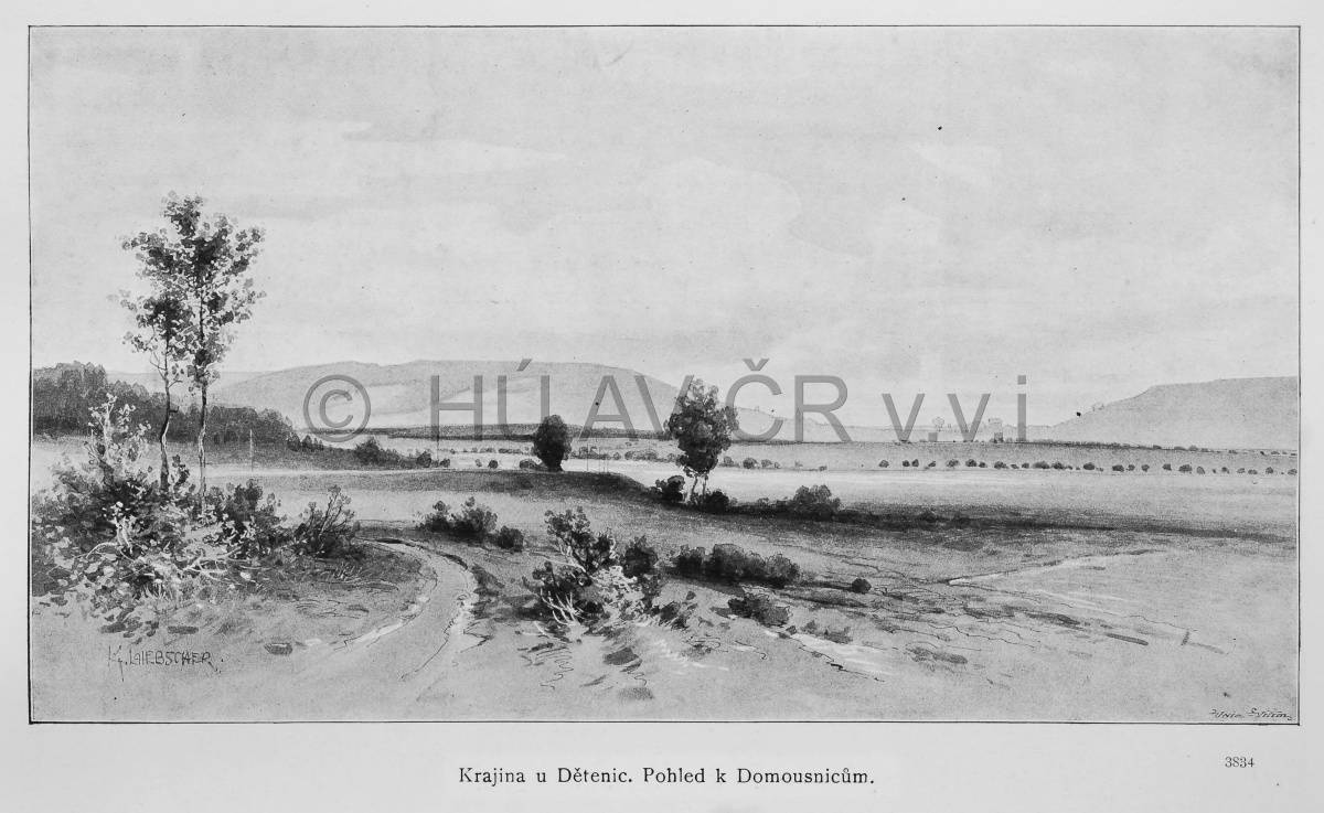
Bohemian rural agricultural landscape in the late 19th century – Dětenice, in: Ottovy Čechy XIV (1908). Library of the Institute of History, CAS.

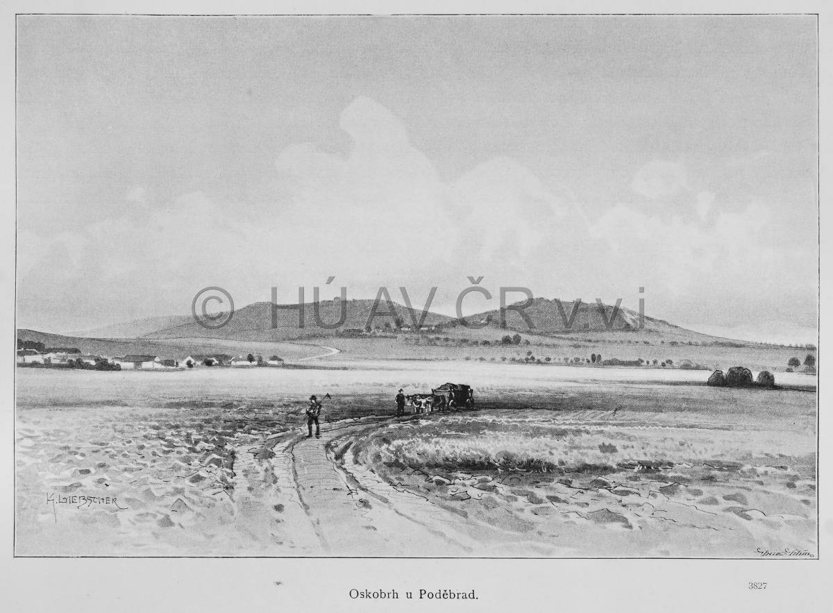
Bohemian rural landscape in the late 19th century – Poděbrady region, in: Ottovy Čechy IV (1888). Library of the Institute of History, CAS.
References
Tempír, Z.: Zemědělství, in: Jílek, F. (ed.): Studie o technice v českých zemích 1800-1918 I., II. Praha 1983, 1984;
Semotanová, E.: Kartografie v hospodářském vývoji českých zemí v 19. a na počátku 20. století. Praha 1993;
Semotanová, E. ‒ Cajthaml, J. a kol.: Akademický atlas českých dějin. Praha 2014, 2. akt. vydání 2016.

This work is licensed under a Creative Commons BY-NC-ND 4.0
Agriculture in the Czech Lands before the First World War
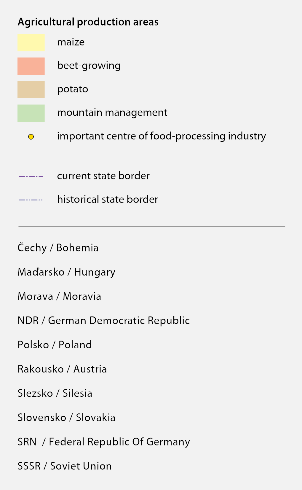
Throughout the 19th century, the systems of farming, structures of the crop areas and thus the scope and structure of the land resources changed. The arable land area increased at the expense of pastures and vineyards. The individual regions, i.e. corn, hops, grapes, potato, beet, fodder, or mixed growing areas were gradually formed. The share of industry in processing agricultural production increased in the second half of the 19th century for example in the sugar, beer, or distilling industries. The foundations of agro-industrial complexes were laid.
Bohemian rural agricultural landscape in the late 19th century – Dětenice, in: Ottovy Čechy XIV (1908). Library of the Institute of History, CAS.
Bohemian rural landscape in the late 19th century – Poděbrady region, in: Ottovy Čechy IV (1888). Library of the Institute of History, CAS.
References
Tempír, Z.: Zemědělství, in: Jílek, F. (ed.): Studie o technice v českých zemích 1800-1918 I., II. Praha 1983, 1984;
Semotanová, E.: Kartografie v hospodářském vývoji českých zemí v 19. a na počátku 20. století. Praha 1993;
Semotanová, E. ‒ Cajthaml, J. a kol.: Akademický atlas českých dějin. Praha 2014, 2. akt. vydání 2016.
This work is licensed under a Creative Commons BY-NC-ND 4.0
Agriculture in CSR in 1930s
In the interwar period, the level of Czechoslovak agriculture increased due to numerous technical innovations. Intensive meliorations, drainage of wetlands and cultivation of infertile and devastated soils improved the quality of almost a quarter of a million hectares of land. Regulation of watercourses continued. The major agricultural production regions consisted of beet in Bohemian Polabí and Moravian Prostějov, Kroměříž and Kojetín, cereals (up to 60 % of arable land was sown with cereals) and cereal-potato regions, mainly in the Bohemian-Moravian Highlands. The crops included hops, fruit and vegetables, flowers and medicinal herbs and also vines to a lesser extent. In the mountain fodder plant regions, shepherding became widespread as a form of Alpine economy. The Forest Protection Act of 1918 contributed to the improvement of state forests. The Land Reform Act of 16 April 1919, which involved the claim of large land properties exceeding 150 hectares of agricultural land or 250 hectares of land in general, was of extreme importance. With certain exceptions, the state committed itself to purchase the land from its original owners. To implement the law, the National Land Office was established, but the reform had not been completed by 1938.
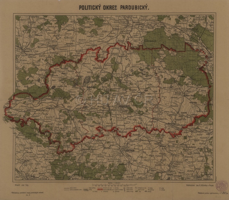
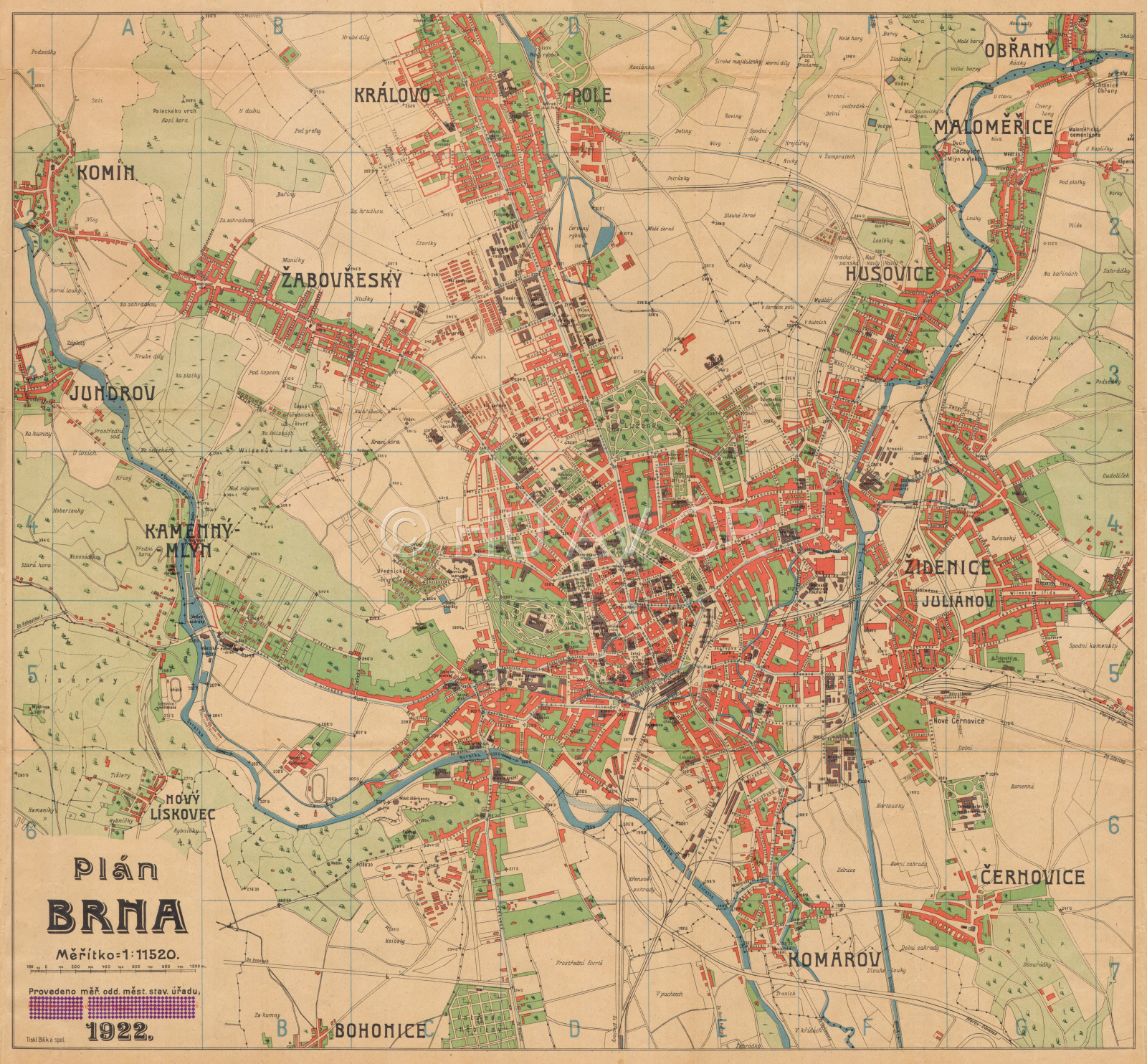
Deforested agricultural landscape on the map of the Pardubice political district in 1928. Map Collection of the Institute of History, CAS. Display map
References
Purš, J. a kol., Atlas československých dějin. Praha 1965;
Semotanová, E. a kol.: Česko. Ottův historický atlas. Praha 2007;
Pánek, J. – Tůma, O. et alii: Dějiny českých zemí. Praha 2008, 2. vyd. 2018;
Laštovička, J. – Kabrda, J. – Štych, P.: Stabilní prvky v české venkovské krajině – dědictví minulých staletí. Geografické rozhledy 23, č. 5, 2014, s. 10–11.
This work is licensed under a Creative Commons BY-NC-ND 4.0
Landscape changes caused by collectivisation of agriculture in the mid-20th century
The present landscape was most seriously damaged by the socialist industrialization and collectivization accompanied by massive land consolidation and removing ecologically and aesthetically valuable landscape structures (wetlands, baulks, thickets, riverbank vegetation, dirt roads, etc.). This activity resulted in the great enlargement of the fields, shortening the dividing lines in the landscape, and simplifying the landscape micro-structure with many negative impacts. The risk of soil erosion increased, water drainage quickened, biodiversity decreased, natural regulatory relations in the ecosystem decreased and the aesthetic value of the landscape dropped. On six selected probes covering various areas of the Czech Republic, it is possible to compare the heterogeneity of agricultural areas in the early 1950s with the current state.
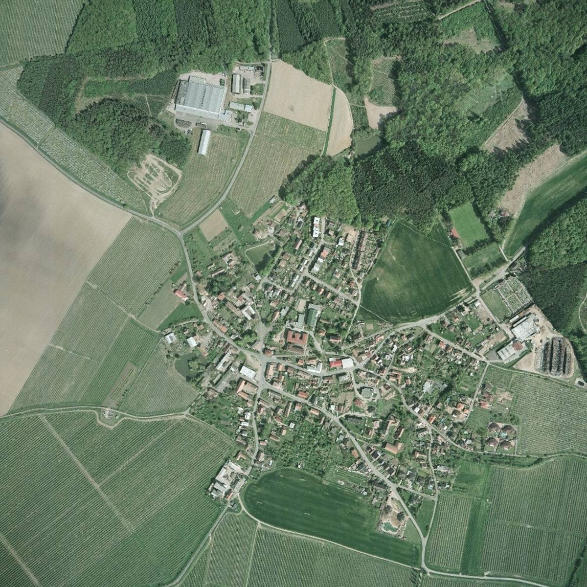
The results of transformations of rural regions after 1945, which were connected with violent collectivization, massive land consolidation and heavy changes in the landscape and the corrective transformational processes following 1989, are apparent in most of the Czech Republic. The picture shows the transformation of the village of Libčany in central Polabí lowlands, large fields and orchards with agricultural complexes in the middle of the village and on its north-west edge (large fruit warehouses). Fruit-growing is the reason why we do not see the typical yellow colour of rape in the photo. Photo Tomáš Burda, 2015.
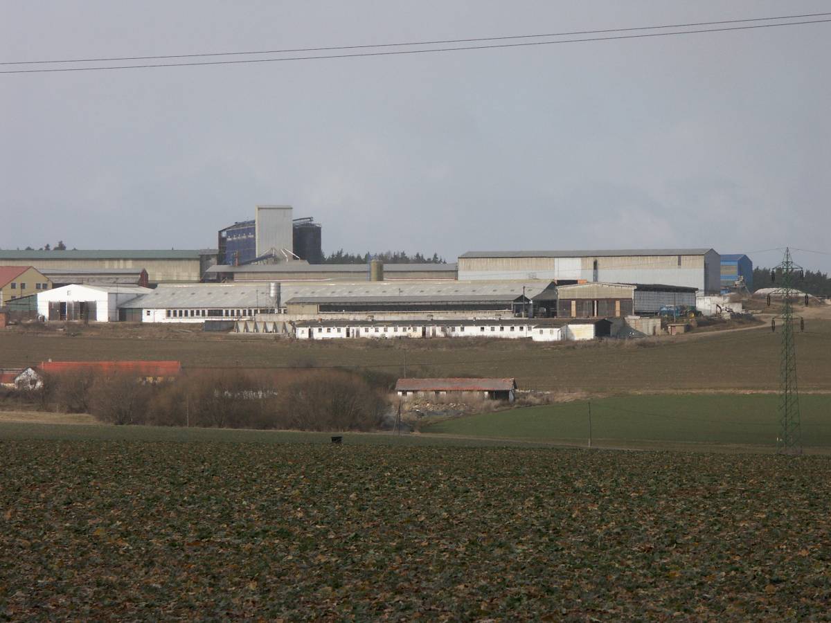
In addition to transformations of the landscape structure, collectivization is also connected with other changes, for example with the establishment of the unified agricultural cooperatives (JZD). The shape of the landscape is thus connected with the construction of large-scale operations (cowhouses, pigsties, etc.). Štichovice (Plzeň-sever). Photo Silvie R. Kučerová, 2008.
References
Laštovička, J. – Kabrda, J. – Štych, P.: Stabilní prvky v české venkovské krajině – dědictví minulých staletí. Geografické rozhledy 23, č. 5, 2014, s. 10–11;
Lipský, Z.: Experience in assessment of landscape character. Ekológia (Bratislava) 19, Suppl. 2, 2000, s. 188–198.
This work is licensed under a Creative Commons BY-NC-ND 4.0
Agriculture in CSSR in 1960s
The transformation of Czechoslovak agricultural production and land ownership, which was of major importance, started after 1949 in connection with the collectivization of agriculture. In February 1949, the National Assembly adopted a law on collective farms as a form of transition to socialist mass production. The collectivization (collective farm creation), which was frequently accompanied by various organisational or technical problems and resistance of many landowners, proceeded in three waves in 1949, 1952‒1953 and from 1955. Lands incorporated in the collective farms were connected in units that greatly exceeded their original areas. Baulks were ploughed, dirt tracks eliminated and the lands were made by consolidation of fields and meadows. The danger of soil erosion increased, water drainage quickened, biodiversity decreased, natural regulatory relations in the ecosystem became limited and the aesthetic value of the landscape dropped. Urbanization, industrialization and road construction together with improper land management practices resulted in a decline in the land resources.
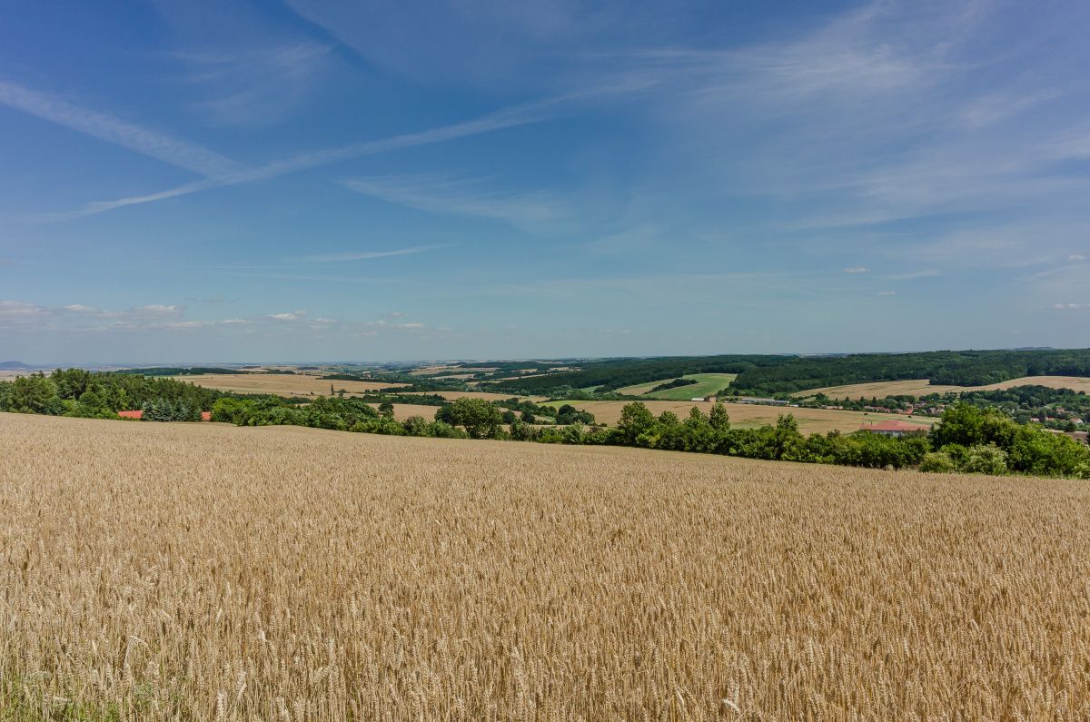
Central Bohemian agricultural landscape in the Slaný region. Photo Pavel Vychodil, 2015.
References
Purš, J. a kol., Atlas československých dějin. Praha 1965;
Semotanová, E. a kol.: Česko. Ottův historický atlas. Praha 2007;
Pánek, J. – Tůma, O. et alii: Dějiny českých zemí. Praha 2008, 2. vyd. 2018;
Laštovička, J. – Kabrda, J. – Štych, P.: Stabilní prvky v české venkovské krajině – dědictví minulých staletí. Geografické rozhledy 23, č. 5, 2014, s. 10–11.
This work is licensed under a Creative Commons BY-NC-ND 4.0